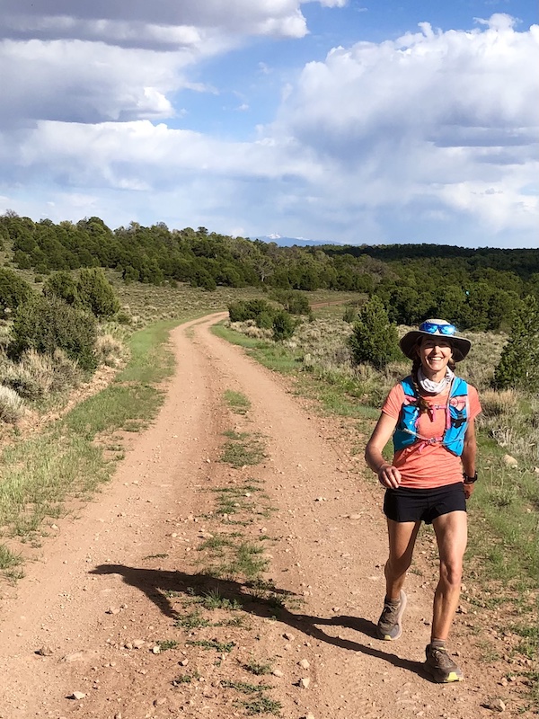
Shortly after 5 a.m. on Thursday, I ran westward down a road near the remote town of Nucla, fueled by excitement, nervousness and a little pride.
No cars drove by, no lights shown in the smattering of ramshackle farm homes, no streetlights lit the way. Only the sound of sprinklers irrigating acres of hay fields gave a sign of life and filled my ears. A full moon and my headlamp lit the way. I carried a pack heavy with nearly a gallon of water, plus enough snacks and safety gear to get me through an all-day journey when I’d be out of cell range and alone for the first two-thirds of the way.
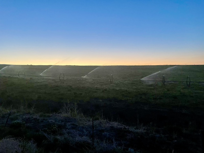
Daybreak during the first miles of my 54-mile run from Nucla, next to ranch land being irrigated.
The strong emotions came from the realization that I had actually planned and embarked on a personal adventure—to run more than 50 miles to a campground next to the Utah border, trying to arrive by dinnertime, to meet Morgan and camp overnight. It’s one thing to sign up for a race and show up; it’s another, and in some ways more thrilling, to plan something on your own and make it happen.
Nucla is a small ranching and mining town about 50 miles northwest of my home. Rural and working class, it has fallen on hard times since its coal mine and coal-fired power plant shut down over the past couple of years, but it’s trying with some success to rebound as an outdoor-recreation destination.
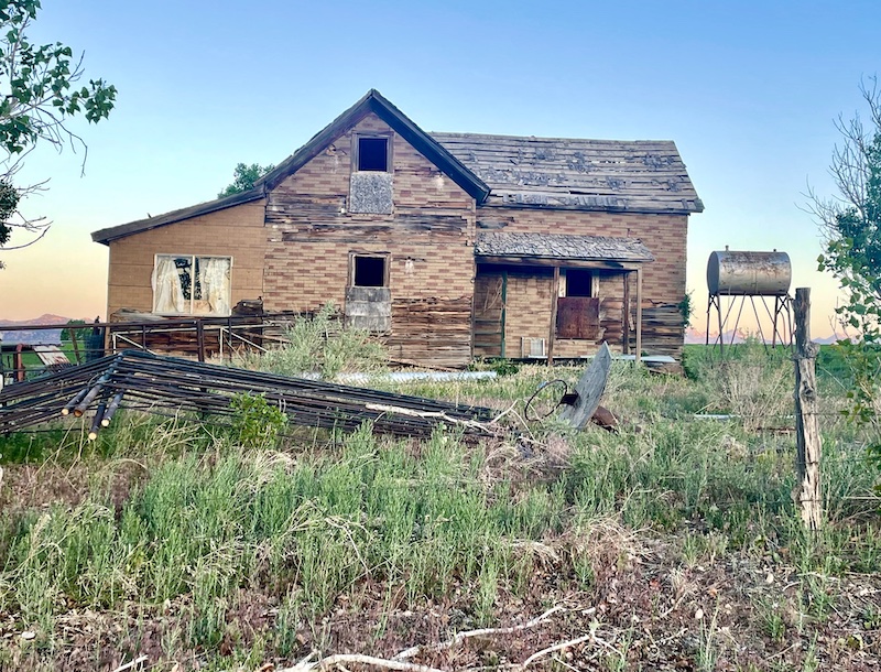
A deserted home I ran past.
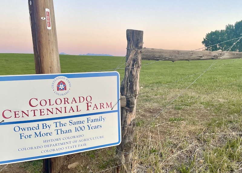
A sign of pride.
I came out here because in the course of researching the region to write an article for Telluride Magazine this spring—and to learn more about my grandfather’s history out here—I discovered the network of trails over red-rock bluffs and through canyons carved by two major rivers.
One route caught my attention, the Rimrocker Trail. It’s not actually a trail but rather a connection of old mining and forest-service roads stretching 160 miles from Montrose to Moab. In 2017, officials from Montrose County, San Juan County in Utah and the U.S. Forest Service linked, branded and promoted the route for OHVs (off-highway vehicles), 4WDs and mountain bikers to showcase the scenery and promote tourism. I don’t think anyone has ever run or hiked it.
Could I cover all 160 miles by foot? Probably. I thought about it and checked the fastest-known-time site to see if anyone has done it on record—nope.
Then I got real. To do the whole thing would take far more time and energy than I wanted to give, and it would take more support of crew driving to remote spots to bring me water and supplies than I wanted to coordinate.
Sometimes it’s best to scale down adventure fantasies to what really feels right and motivating.
What did I want to do? I wanted to run “only” the middle third of this route—the most scenic part—and then enjoy camping overnight with my husband and dogs. That would be enough, and challenging. I can’t knock off a 50ish miler like I could when I was in my 40s and in peak shape. I’m not in great shape now for a 54-mile effort through a high-desert landscape with hot afternoon temperatures, but I knew the depleting day would get me in better shape for two races coming up—the Bears Ears 50 mile on June 26, and the High Lonesome 100 July 30.
Those who are familiar with the region might wonder why I chose the Rimrocker Trail—which is really a road—rather than a long, wild singletrack route through the region. Truthfully, the fact it’s a dirt road rather than singletrack, with signage along the way, appealed to me for safety. I didn’t want to worry about navigation, and I wanted a more runnable route.
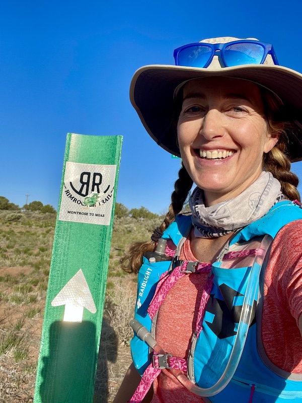
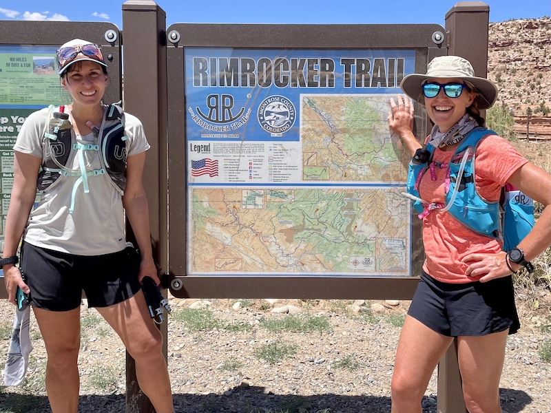
These signs with the Rimrocker logo mark the route.
I chose a weekday to take advantage of the full moon and to avoid the Memorial Weekend crowds. I spent Wednesday night in Nucla to get an early start at exactly 5 a.m., wanting to reach the campground while the sky was still light, in under 15 hours. I stayed at a sweet little bed-and-breakfast that opened last fall in Nucla, The Vestal House, but its four rooms were booked up, so the owner rented me her “glamper” camper parked in back, which was plenty comfortable and cozy.
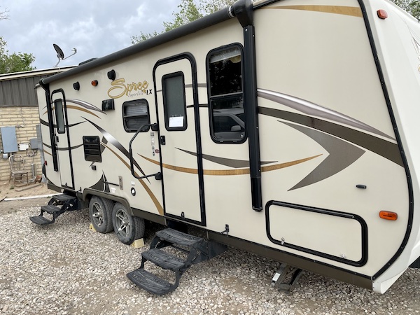
My lodging the night before the run.
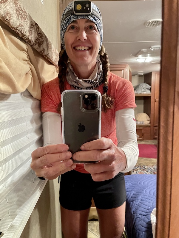
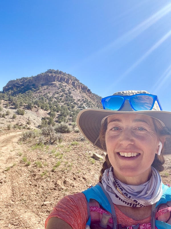
Obligatory awkward morning selfie. #manhands
I woke at 4 a.m. and prepped everything in my bag: a 50 ounce reservoir of water, two 17-ounce soft flasks filled with Rocktane drink mix, and a 20-ounce Katadyn bottle filled with water, which has a water filter, so I could refill at a stream crossing. I had to carry enough fluid to get me to mile 36, where my friend Christina Dennison and her husband Justin would meet me with water, and Christina would accompany me the final 18 miles. Temperatures would reach the low 80s but feel hotter along the shade-less route, with heat reflecting off the light-colored dirt and sand.
I also carried first aid to cope with a fall or rolled ankle, a bunch of snacks, a SPOT Gen 3 tracker with an SOS button, a charger for my phone, a fresh pair of socks and a windbreaker, sunscreen and anti-chafe lube … all the familiar stuff needed for a long self-supported run. But for the first time, I added some personal protection in the form of pepper spray. I thought I might encounter off-road drivers, and who knows? One might be creepy and harass me. As it turned out, the road was almost entirely deserted on this weekday. I saw no one for the first six hours or so. Then I passed a friendly Jeep at around mile 28, and then Christina and I got passed by a vehicle in the late afternoon, and that was it.
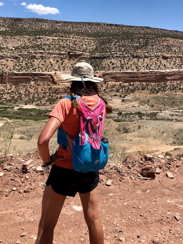
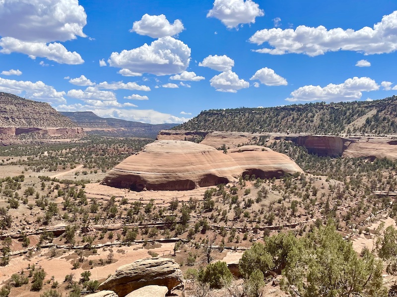
Running westward, I enjoyed the sun on my back and followed my long shadow as the route transitioned from grassy farms and ranchland to rugged canyonland with scraggly juniper trees and cacti. Red, yellow and green-hued minerals colored the canyon sides.
Westward bound with the sun on my back, the snow-capped La Sals in the distance.
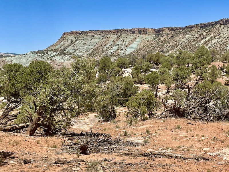
Reds, greens and yellows in the mineral-laden rock layers.
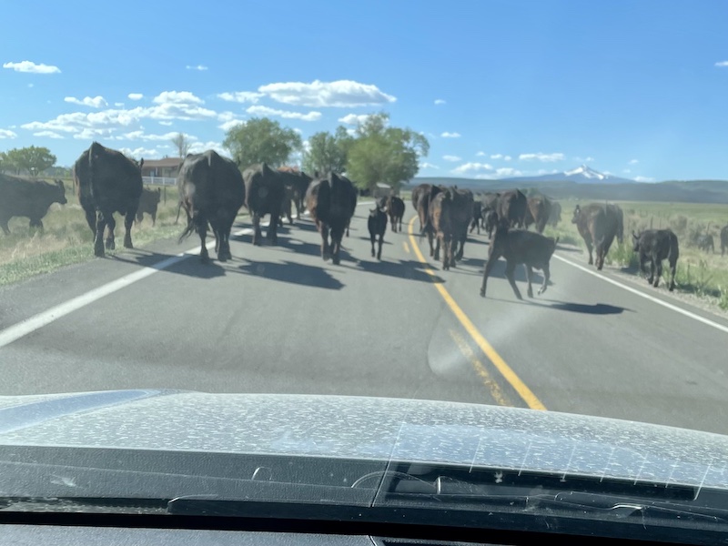
Of all the injuries and hazards I prepared for—bloody knees, sprained ankle, heat exhaustion—the threat of cows never crossed my mind. But when I descended into a canyon just west of the historic uranium mining town of Uravan (which no longer exists, since its radioactive buildings were razed and buried as a Superfund site—but that’s another story), I encountered dozens of cows and calves startled by my appearance. Frightened cows, mooing in protest, kept blocking the way, and I knew better than to get between a mother cow and her calf or she might charge at me. So I slowed to a walk, clapped my hands to make noise and repeatedly called out, “Hey, cows, mooooove!” Several times I had to stop and walk carefully around cows who were not happy to see me. Thankfully they all decided to run away rather than charge in my direction.
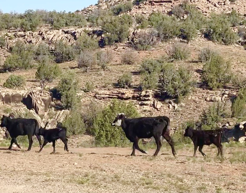
A few of the dozens of cows I disturbed.
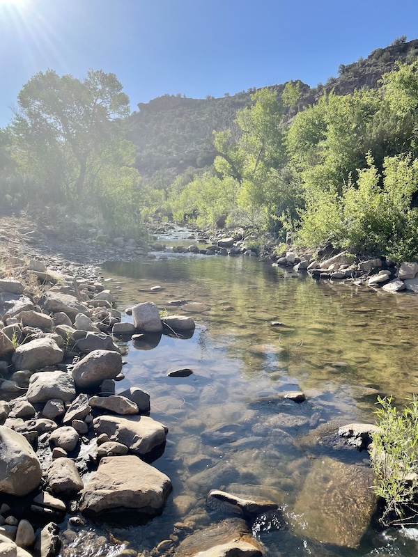
Tabeguache Creek
Around this time, I reached the Tabeguache Creek crossing where I planned to refill the Katadyn bottle that has a water filter, which I did. But I realized that all those cows had undoubtedly contaminated the water with their cow pies and urine, and I didn’t trust the filter to make the water clean enough to drink. So I decided not to drink that water from the stream and to use it only for cooling off my body as the day got hotter. This meant I would have to conserve the fluid in my reservoir and two 17-ounce soft flasks to last to the meeting point at mile 36.
Thinking about those cows made me think about my grandfather, David S. Lavender. Cattle ranching brought him—and by extension, me—to this area. My grandfather’s stepfather, Ed Lavender, owned the Club Ranch for a time in the late 1920s and early 1930s, one of the largest and most successful cattle ranches in western Colorado. The ranch was located right across the highway from where I was running, and I know Grandpa would’ve ridden and driven the roads I was running, because he used to ride from the ranch to the town of Nucla. My grandfather worked there in winters during his young adulthood, during the onset of the Great Depression, and he and other cowboys would ride horseback for days to drive hundreds of cattle from this lower-elevation area to summer grazing lands closer to Telluride. I always think about him and try to picture what his adventures were like. Thankfully, he wrote a memoir that vividly describes those days, One Man’s West, so his story lives on and inspires me.
As I expected would be the case, I felt good and ran steadily and problem-free the first 20 or so miles, because that’s the length of my typical long run. The weight of my pack (about 10 pounds) slowed me, and I downshifted to hiking on any stretch that felt too stressful to run. The first two-thirds of this segment features rolling hills; the big climb of the day would come toward the end.
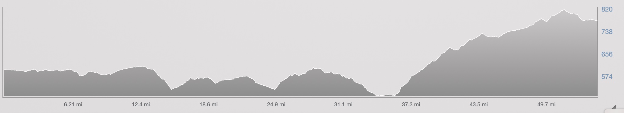
The Rimrocker Trail elevation, from Nucla to Buckeye Reservoir, from a low of about 5000 feet at the crossing of the Dolores River, to a high of about 8200 feet on the plateau overlooking Paradox Valley.
I wanted to average around 12 to 13 minutes per mile, so by limiting hiking and other breaks during the morning, I managed to maintain close to 5 miles per hour. I knew I would slow down in the afternoon heat and take a long break at my meeting spot with Christina, and then slowly hike the 3000-foot climb that came around mile 36, so I needed to bank time in the first half of the day to make it to camp before nightfall.
“Did somebody just turn up the heat?”
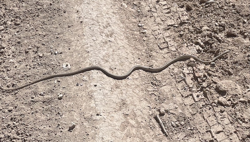
I stepped over this sunbather.
Between miles 26 and 36—around 10:30 a.m. to 1 p.m.— fatigue, heat and thirst set in. Listening to podcasts and music helped. My slowly baking brain found it hilarious that right at mile 27, the halfway point, Jon Bon Jovi came on singing “whoa, oh, we’re halfway there, whoa, oh, livin’ on a prayer…” and I had no memory of ever adding that song to my playlist.
I looked down and saw my hands puffed up and my fingers like fat sausages. Thankfully, I had the foresight to take my wedding ring off before the run. No matter how well I balance fluids and electrolytes, I get puffy hands in the heat.
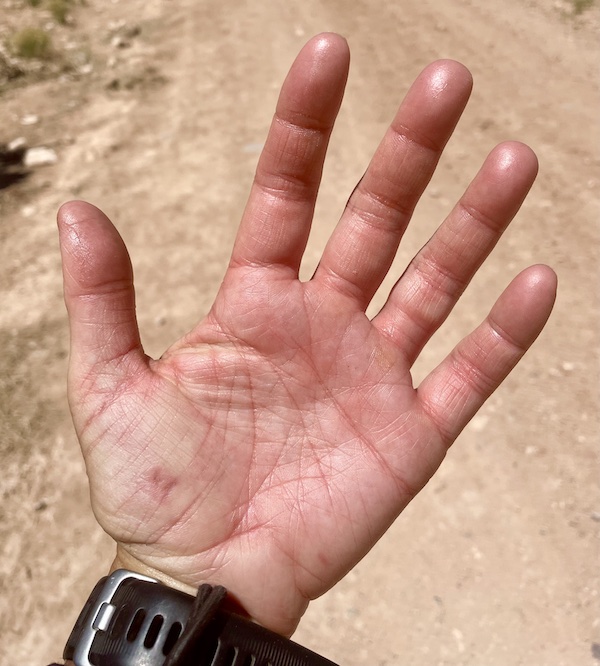
Hot swollen hand #puffyhands
My mouth felt dry, my fluids were almost empty. Around mile 34 I had the last remaining sips and had faith I’d get fresh water and ginger ale when I met my friends in two miles. I tried to relax into the heat, which was only in the 80s. I told myself this wasn’t too hot—I had run in triple-digit heat through desert plateaus in the Grand to Grand Ultra.
Running above Highway 141 during the miles that were in the mid-20s to low-30s. At around mile 34, the route drops down to the highway, crosses the highway and river, then climbs up a massive bluff on the west side.
After running along a shelf of a rugged road high on the canyon wall, overlooking scenic Highway 141 and the Dolores and San Miguel rivers, I dropped down to the highway and started to feel the twinge of protest from sore quads and feet. I popped onto the highway around mile 35, at about 5000 feet elevation, and ran the shoulder of the paved road down to our meeting point—a bridge crossing the Dolores. I fantasized about drinking cold ginger ale and cooling off in the river.
Christina and Justin had driven two hours from Ouray to meet me. I knew I could count on them. I’m so grateful for the running friends who support me in this odd, shared hobby that we do. They were waiting with a folding chair, cooler and potato chips.
I thanked them but bypassed their goodies to go down to a shaded spot under the bridge, where Justin was fishing, to escape the sun. I stepped into the water and sat down on the muddy river bottom, splashing water all over my arms. For several blissful minutes I just sat there while taking deep, calming breaths and feeling my core temperature lower. It’s hard to describe how refreshing and relieving those minutes felt. Once I cooled down, I knew I could get back to the route and get to the campground.
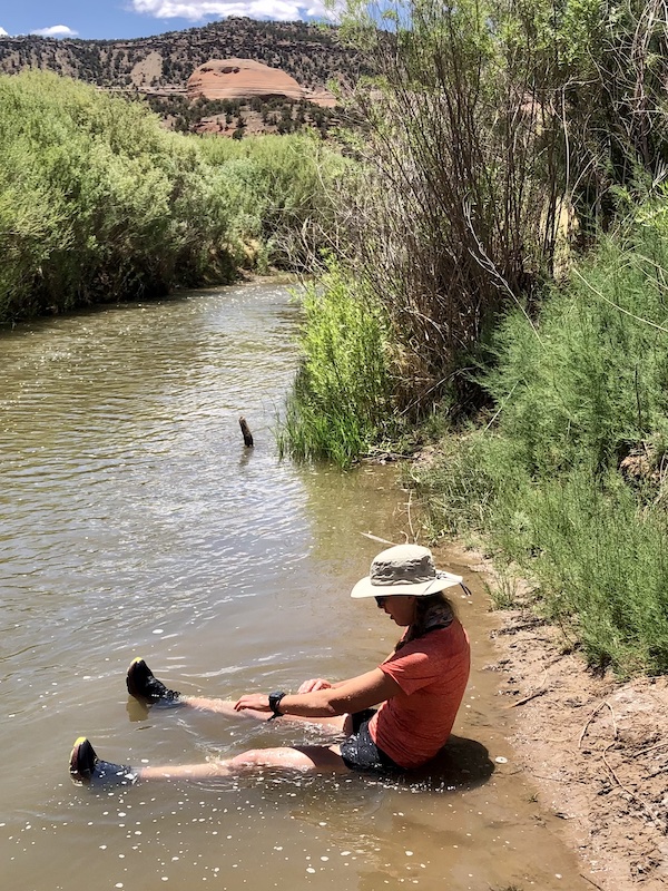
Caption this in the comments below!
I gratefully ate potato chips and guzzled ginger ale, and refilled my water bottles. Then Christina and I got ready to go at about 1:45.
Christina and me setting out at about 1:45 in the afternoon for the final stretch, temps in the low to mid 80s.
Contemplating the climb ahead and the miles still to go.
We set out in the afternoon heat on a steep, rugged road labeled Q13 that leads to Moab. It zig-zagged up the side of the bluff, and our hiking pace slowed to about 20 to 22 minutes per mile. That’s all I could handle on the uphill. We paused to take in views of canyon walls and wind- and water-sculpted rock formations. Eventually, as we ascended above 7000 feet, juniper trees, then ponderosa, started flanking the sides of the road.
Looking southeastward at the canyon, back toward Uravan, from Q13 road.
I didn’t feel very well—I needed calories, but a Clif bar stuck in my throat. I couldn’t alleviate my parched dry mouth. The arch of my right foot started to ache with each step. Blisters erupted. We were around mile 40, with a half marathon still to go, and I could only hike and then run short bursts for 30 to 60 seconds.
Mile by mile we trudged on, Christina wonderfully patient and supportive. She also is training for Bears Ears 50 and High Lonesome 100, and we told ourselves that our slow pace was good practice for the high-alpine challenges of High Lonesome. But we mused out loud about how hard the Bears Ears 50 will be in four weeks, because it will be in a similarly hot, high-desert landscape in eastern Utah, but it will have almost twice as much elevation gain as this portion of the Rimrocker trail. The elevation gain for this day’s 54 miles amounted to only 6800 feet, whereas the Bears Ears 50 has about 12,000 feet of gain and the High Lonesome 100 has about 22,500.
Feeling discouraged, I thought about how I wanted this day’s extra-long run to boost my confidence, but instead it was making me feel more daunted by the upcoming ultras. I snapped out of that negative downward spiral by objectively realizing this is a training run, it’s supposed to feel hard and depleting, and my body should adapt and be more fit and ready for those races after I recover from this extra-long run.
Mostly, I thought about how excited I was to get to camp. Fajitas. Beer. Big reclining chair. I had no idea what the campground would look like. I hoped Morgan would have it all set up by the time I got there.
I run for fajitas and beer.
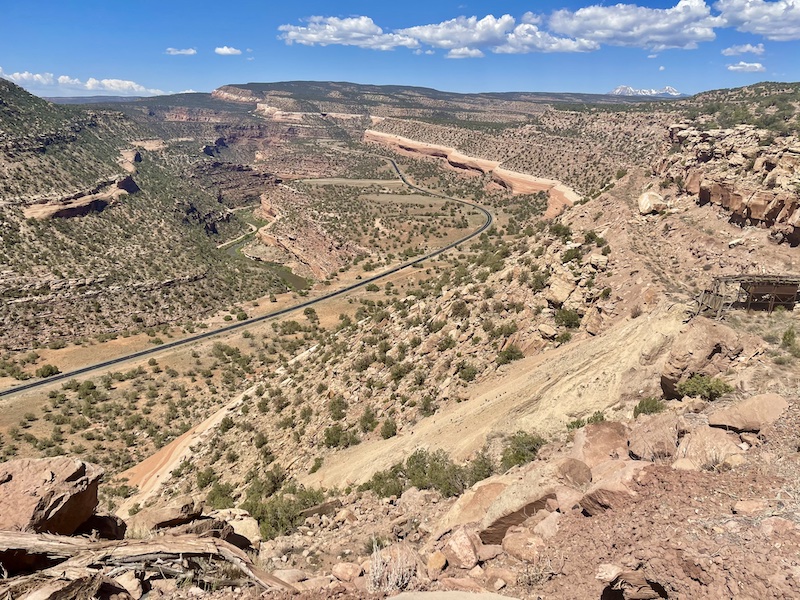
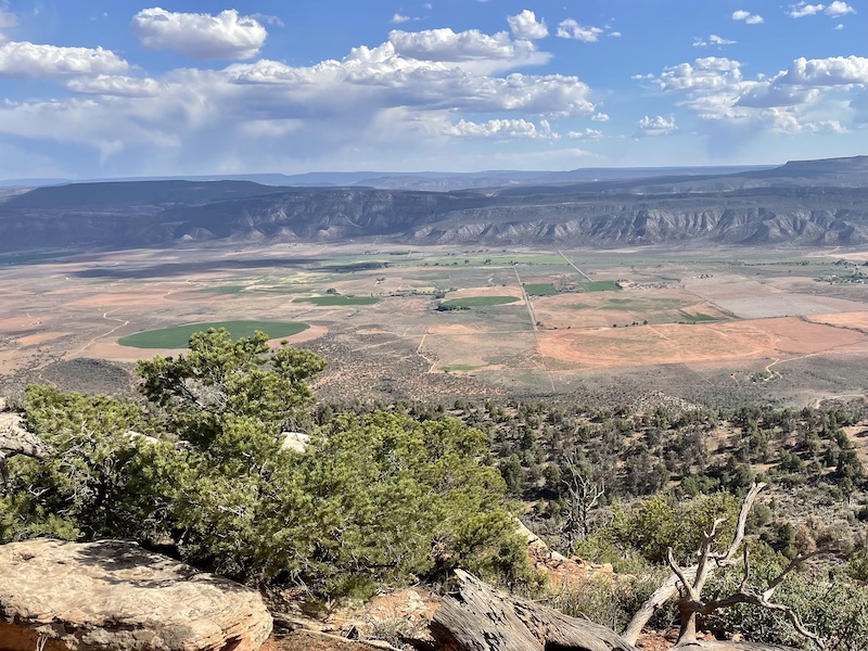
At one point, about three miles from the campground, Christina and I went to the side of the forested road to peer over the cliffs overlooking the Paradox Valley, so named because the Dolores River bisects it perpendicularly from side to side rather than running the length of the valley. My whole life, I had viewed this valley from down low on the other side, while driving by. I loved seeing the expanse from up high, admiring the geometric shapes of the fields below. Some green fields formed perfect circles, rather than squares or rectangles, because of the circular spray of irrigation. I felt proud of myself for running this far and getting up high to gain a new perspective and traverse a new route.
Overlooking Paradox Valley
The ponderosa pines grew thicker and taller as we got over 8000 feet elevation. I gave a little celebratory “whoo-hoo” when I hit 50 miles in 13:12. I was able to run more in the final four miles, eager to get to that reservoir and campground.
The forest opened up to meadows full of thick green grass ringing a small lake. When we saw the sign for Buckeye Reservoir, we took a photo and celebrated, a little prematurely. It turned out we had to run about another mile, two sides of a big triangle, to get to our camp spot.
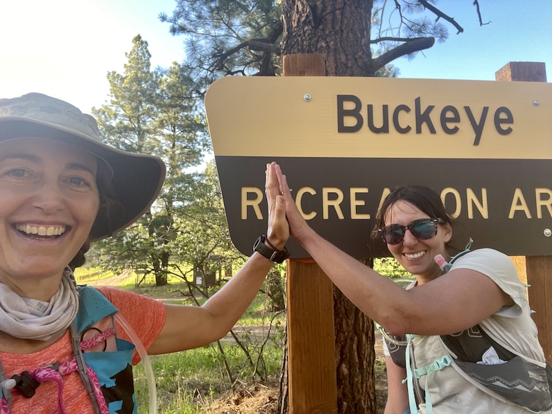
Made it to Buckeye Reservoir!
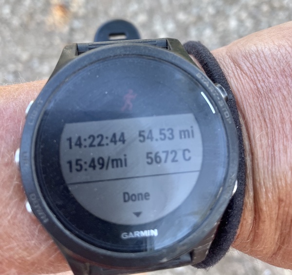
Morgan and Justin were there, enjoying the twilight hour with beer and a fire. I was so happy to see that Morgan had set up our tent and got everything ready in an ideal camp spot, bug-free, no wind, perfect temperature. I had covered 54.5 miles in 14 hours, 22 minutes, and it was so worth it!
I was pretty happy with my pace, given the breaks averaged in and all the uphill hiking.
We had to say goodbye to our friends, who had to get back home. I was so grateful for their support.
Then I thoroughly enjoyed the camp with Morgan and our dogs. I wondered out loud to Morgan, why don’t we do this more often?
“I know,” I told him, “next time I’ll start at the Moab end and run from Moab to here.”
He thought I was kidding.
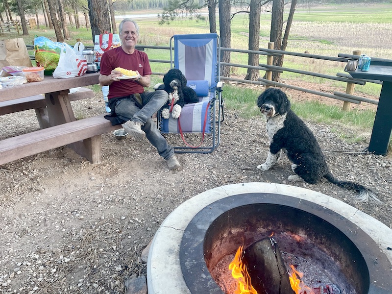
Morgan, Dakota and Beso at camp.
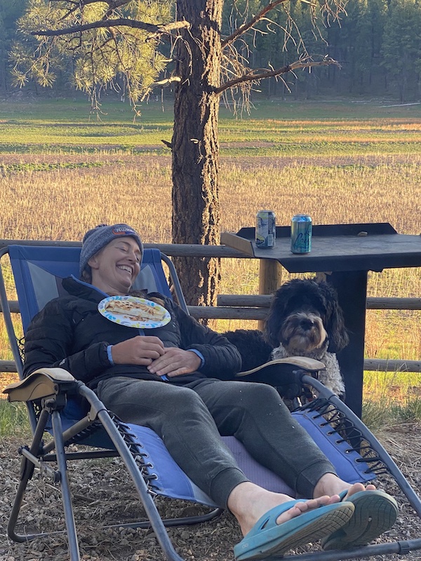
Ahhh … the food was so good, but I had to rest a little before I could eat.
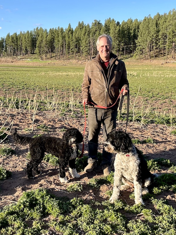
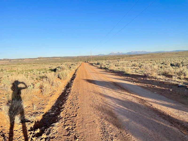
A sunrise walk the next morning.
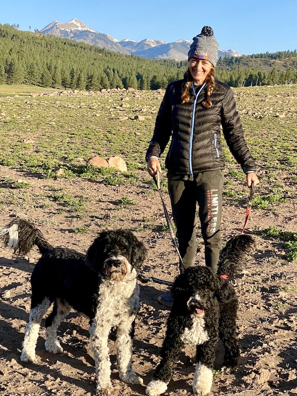
I felt sore but satisfied.
A fitting end to my journey: This traffic jam on the drive home, the snow-capped Lone Cone in the distance. My grandfather used to drive cattle all the way from here to the base of the Lone Cone on horseback.
So cool! I loved how you described your feelings at the start and how they changed up and down thru the day. You are a bad ass!! Can’t wait to have some of my own adventures this summer. Keep playing!
Great story, some of the best adventures are those that you put together and just get out there and do it. Last Sunday myself and three others took off from Idyllwild to run on the PCT to Hwy 74, 37 miles with just under 8,000 feet of climbing with no aid stations. Just us and the mountain. While only two of use finished it was a great time.
Well Done Sarah! Thanks for sharing the great pics along with your courage and trepidations.
Sometimes getting away from the regular running routes and doing something new with a unique destination is the best medicine. I’ve been hemming and hawing over trying a logistically tough run out in the Catskills this summer.
After reading your adventure, now I will do it for sure. Thank you for an inspirational kick in the butt!
Caption for the river cool off…”Welcome to the religion of High Desert Ultrarunning. Here is your baptism.”