Before Morgan and I went on our recent New Zealand trip, we pored over NZ’s Department of Conservation website for info on where to hike and run during the week following the February 7 Tarawera Ultra 100K (see related race report).
Along with eating meat pies, meeting Maori, renting a camper van, and going really fast on a luge or a shotover jet, “tramping” (Kiwi for hiking) one of the country’s nine Great Walks is a quintessential New Zealand experience.
When we traveled around New Zealand five years ago, we explored parts of the Heaphy and Abel Tasman “tracks” (what they call trails there). This time we wanted to head to the southern tip and do one from point to point, all in one day.
Why all in one day? Most visitors take several days to do a Great Walk, and an impressive network of well-built, dorm-like huts, which you can reserve through guides or the DOC website, make camping quite manageable.
But we didn’t want to deal with renting and carrying packs with enough food and sleeping gear for overnight camping. With limited time to explore that region and the desire to hike briskly instead of plodding while weighted down, we wanted to devote only one day to a single track. We thought we’d start in the early morning, carry daypacks with layers of clothing and a picnic, and finish near dinner time.
Of the three Great Walks in the southern region known as Fiordland, Milford Track (53K/33 miles) seemed a little too crowded and hard to access, involving boat rides to the trailheads. Kepler (60K/37 miles) seemed a little long (so we ended up doing part of it out-and-back another day).
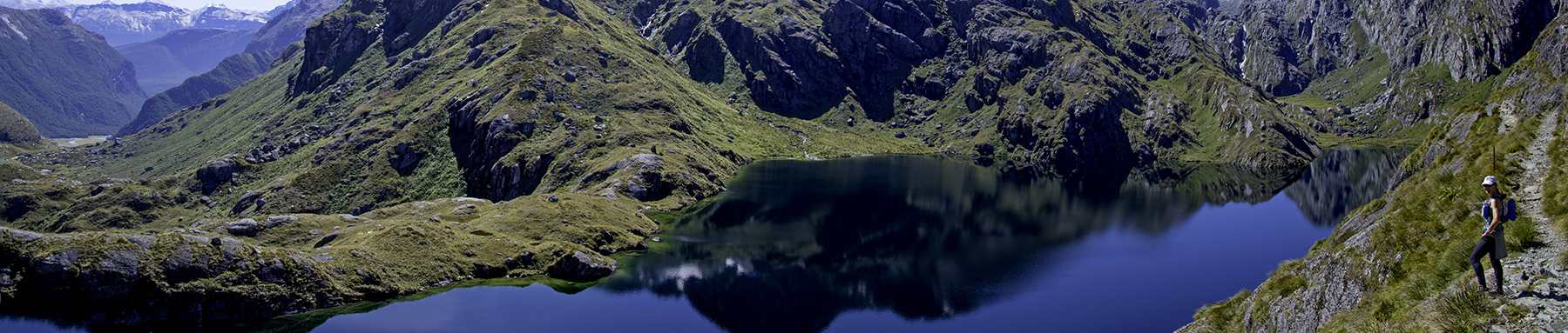
The 32K/20 mile Routeburn, however, seemed just right.
The only thing is, the DOC website made us question whether we really could do it in a day. It says you need 2 to 4 days, and you must reserve a bed in a hut a long time in advance.
With some digging around, however, we discovered you really can do the Routeburn in a day and you don’t need a permit. It’s not that hard. Locals do it all the time.
If you hike leisurely at 2 miles/hour, it will take you around 10 hours, say 8 a.m. – 6 p.m., which is not a problem this time of year because the sun stays out well past 8 p.m. Morgan and I averaged closer to 2.5 miles/hour. We stopped quite a bit to take photographs and picnic, but then we gained time by running parts of the smooth, downhill stretches during the second half. We finished in 9 hours.
I concluded that the DOC’s message about the route taking 2 to 4 days is probably a well-coordinated and well-intentioned effort between the government and third-party providers to get people to pay for guides, pay to rent camping gear, pay for huts and not overextend themselves physically. [Update: see the first comment from Glen below, which is a good note of caution. He says it takes 2+ days in snowy inclement weather.]
Here’s a step-by-step guide of what you need to do:
1. Choose your direction.
You can start at either end. We started at the Routeburn Shelter and ended at The Divide, which is the right-to-left direction of this map:
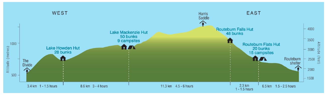
The Routeburn Track elevation profile (click to enlarge)
The Routeburn Shelter trailhead, near Glenorchy, is a little over an hour from Queenstown. The Divide trailhead is closer to Milford Sound. To drive all the way from one end to other takes about 4 hours, 45 minutes. If you start at the Routeburn Shelter (Glenorchy/Queenstown side) and end at The Divide, then you’re closer to Milford Sound, where you can explore the next day (which we did).
2. Book a room at Milford Lodge if you hike the Glenorchy to Milford direction.
If you want to stay and explore Milford Sound the day after your hike, book a room for a night or two at Milford Sound Lodge, the only place to stay in that area and closer to The Divide trailhead than the town of Te Anau (except for Mitre Lodge, which looked aging and rundown). You could stay at Te Anau, but then you have a long drive to Milford Sound. The Lodge books up far in advance. It offers a small number of lovely self-contained “chalets,” affordable dorm-style rooms with a shared bathroom, and a high-quality cafe. Where the Routeburn track ends at “The Divide,” on the Te Anau-Milford Highway, it’s a 35 minute drive to Milford Sound Lodge and an hour-plus drive in the other direction to Te Anau.
3. Arrange to have your car transported from one end to the other while you hike.
A couple of car transport services operate in the region. We went with Trackhopper, founded and run by a Kiwi named Mike Stone, who was very responsive when making arrangements and trustworthy with our car and possessions. He and his wife transport people’s cars from one end of the track to the other (a 4+ hour drive)—then they run back over the trail to return to their home. They are both talented trail runners.
We were staying at a hotel in Queenstown the day before doing the Routeburn, so we arranged the following timeline: Check out of our hotel and hit the road by 6:45 a.m.; drive 45 minutes to Mike’s house in Glenorchy by 7:30 and pick up Mike; then Mike gets in our rental car and directs us to the Routeburn Shelter trailhead, about another 20 minutes away. We handed the keys to the car to Mike, which held all our belongings (but we hiked with our passports and wallets, just in case our car got broken into—highly unlikely). We hit the trail around 8 a.m.
Mike then drove our car to Te Anau, filled it with gas, then drove and parked it at The Divide trailhead at the other end of the Routeburn. He used a lockbox and put our key in it. He had given us the combination to the lock box. Fast forward 9 hours, and our car was right where he said it would be, parked and locked, when we finished our hike; we were able to get the key, get in our car and drive to Milford Sound without a problem.
4. Dress in layers of clothing and take enough food for the day.
When we started, it was cold enough that I wore running tights, gloves, a long-sleeve wool shirt with a tank top underneath and a lightweight waterproof jacket. (We lucked out and had perfect weather, but rain is always a high possibility, so bring rain gear.)
Since I’m an Ultimate Direction Ambassador, Morgan and I got to test out two excellent UD packs. (FYI these links go to UD’s site and if you purchase them, I will receive a very small commission. Trust me, I would not promote these links unless I truly recommended these products!)
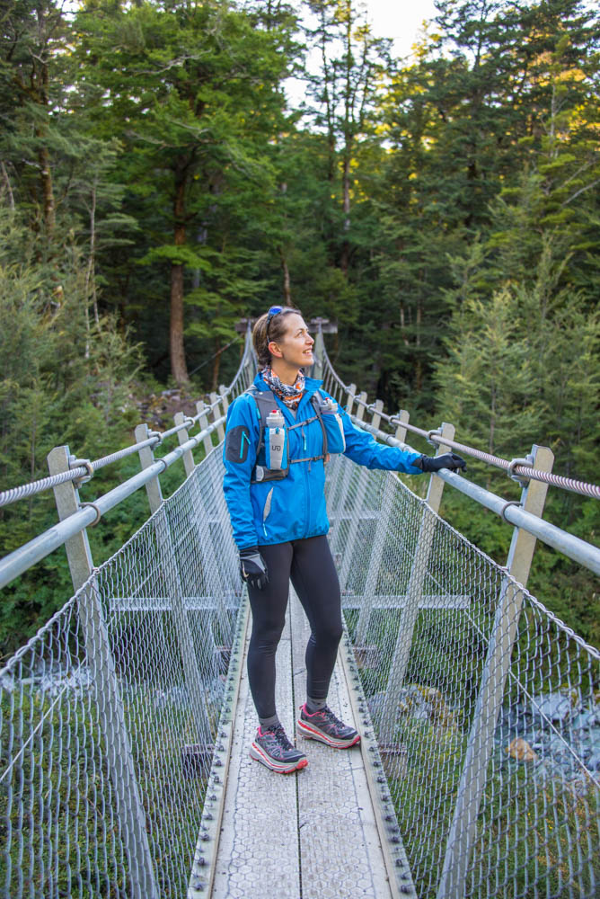
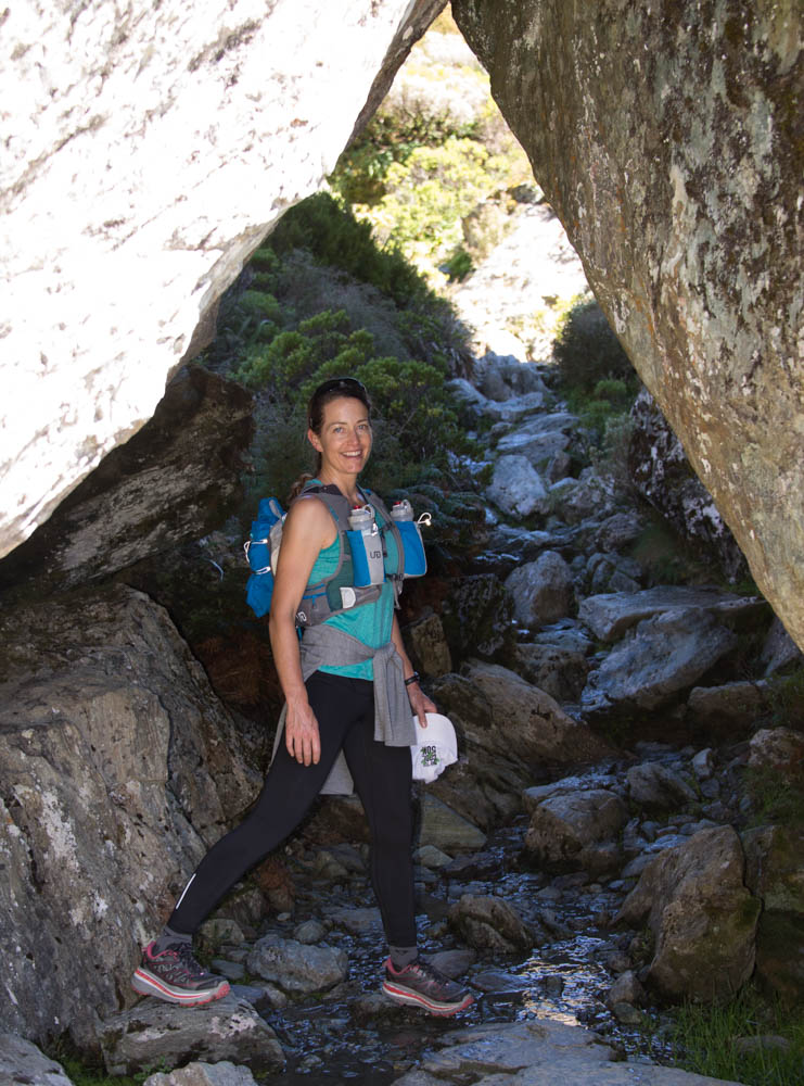
I used the SJ Ultra Vest 2.0, which had just the right amount of carrying space and pockets for this day trip. I carried food, some basic first aid and a blister kit, sunscreen, and my wallet and passport. As I shed layers during the day, they easily fit in the pack. I liked how the bungee cord on the outside of the pack worked to hold my bulkier jacket.
I found out, however, I did not need to take both water bottles, because the water on the track is plentiful and safe to drink! So, you can get by with just one bottle and refill it at streams.
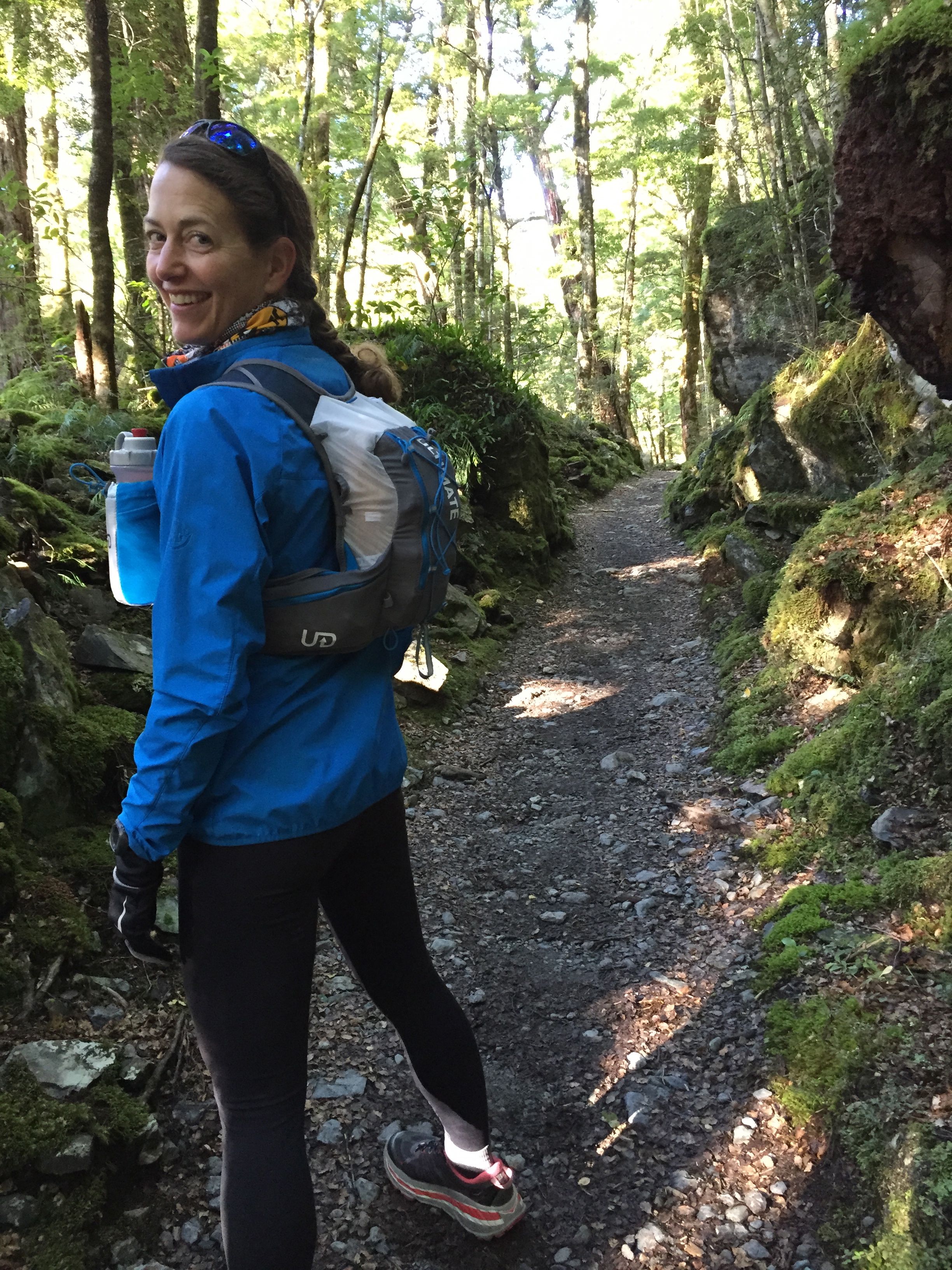
How I dressed in the cooler morning at the start of our hike, using the Ultimate Direction SJ Ultra Vest 2.0
Morgan had camera equipment to carry in addition to some extra clothing and food, so he used Ultimate Direction’s roomier Fast Pack 20. We like how the top of this pack folds and functions like a dry bag. It gave him plenty of carrying capacity and useful pockets for smaller stuff.
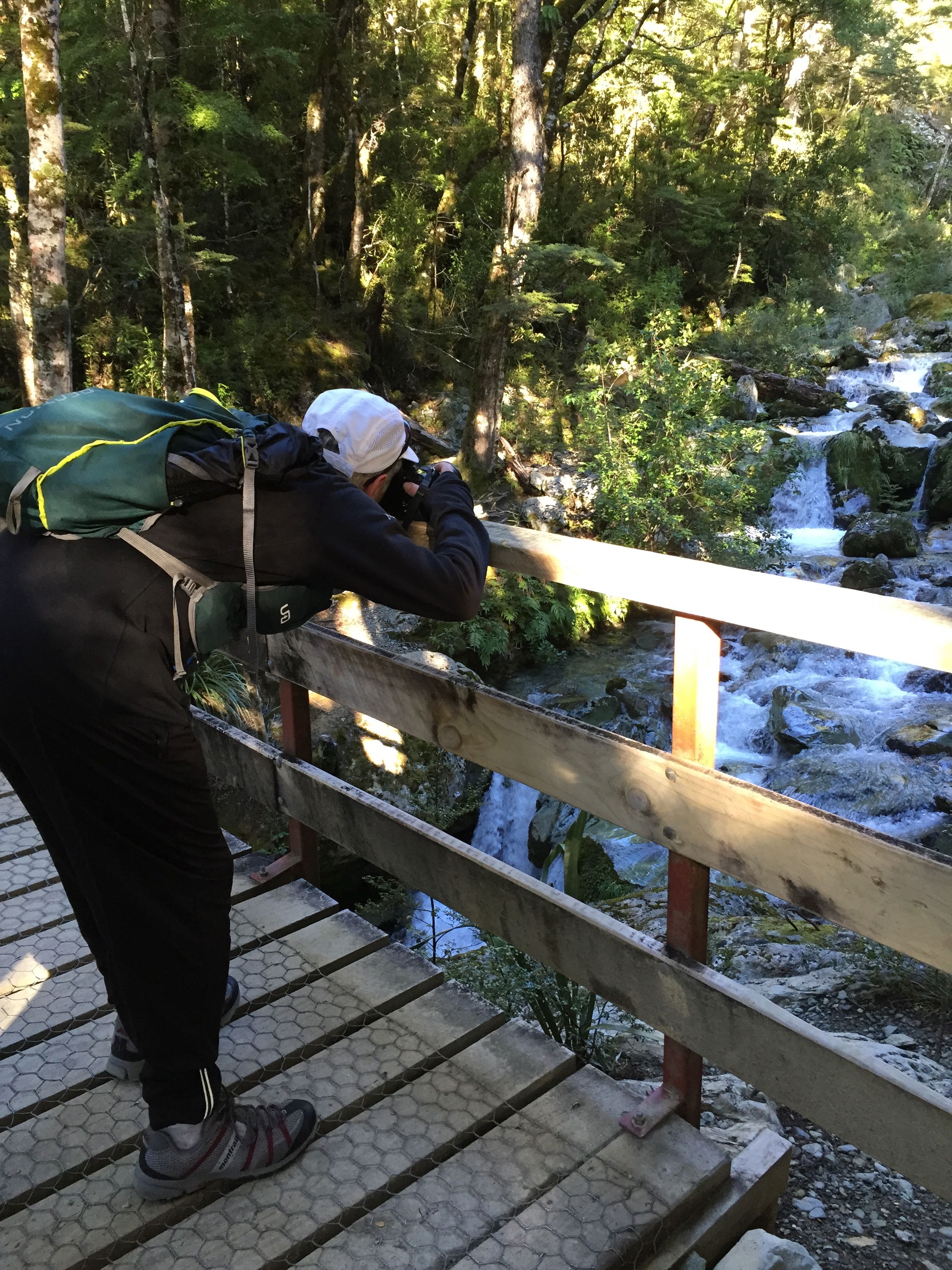
Morgan taking a pic during the first few miles of the hike; this shows his Ultimate Direction Fast Pack 20.
We also carried one pair of trekking poles, the Black Diamond Lightweight Z Poles that fold and carry easily in a pack. Morgan thought he’d use them. It turned out he wanted one hand free to steady the camera around his neck, so he only used one of the poles and I carried the other. It worked out nicely to share a pair.
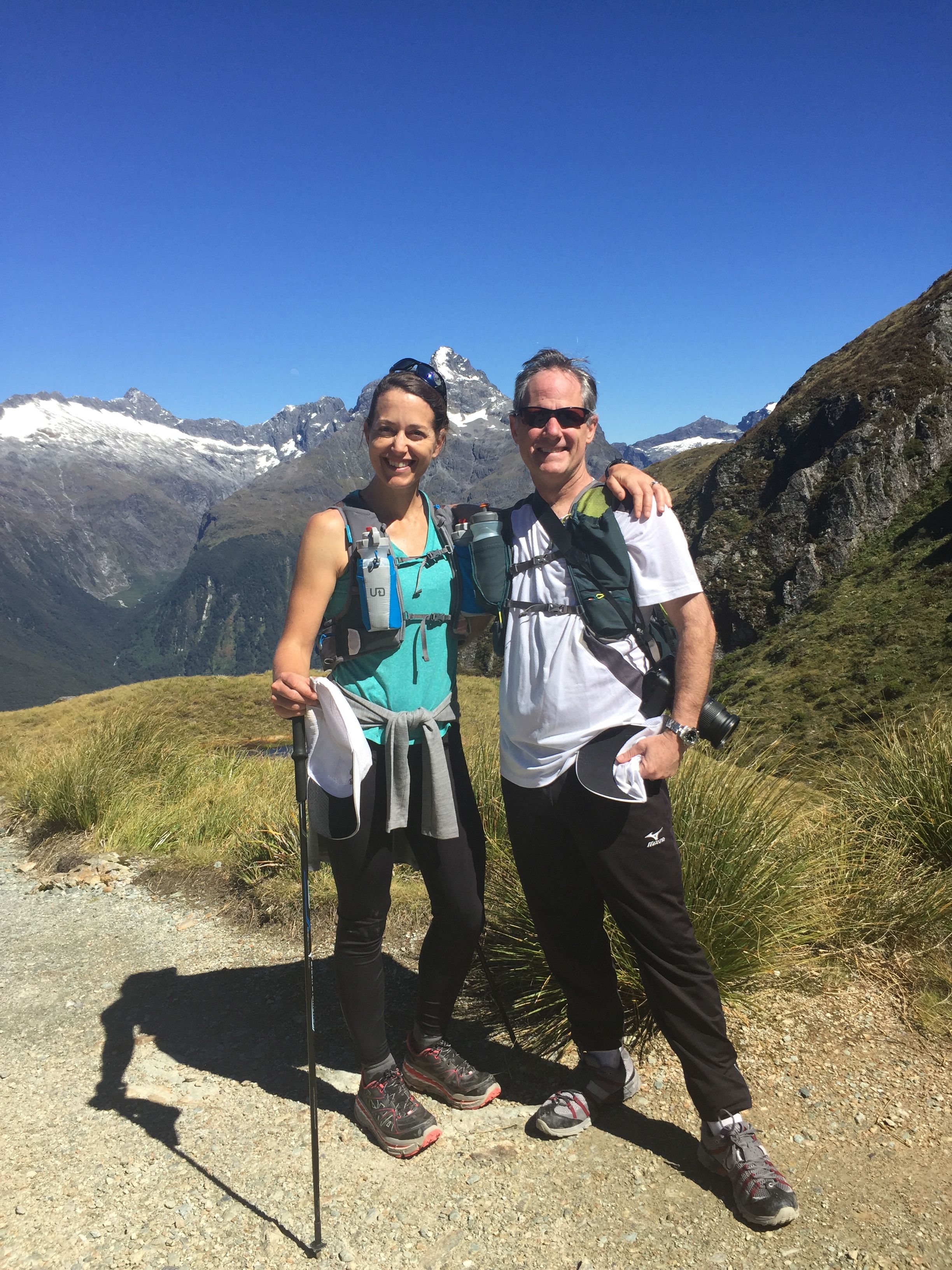
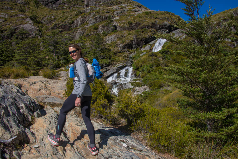
Morgan and me at the Harris Saddle summit, and I’ve got one of the poles. We were so blessed with blue sky!
5. Enjoy the hike!
These photos show the different stretches of the trail from the Routeburn Shelter to the Divide.
The first of several bridges.
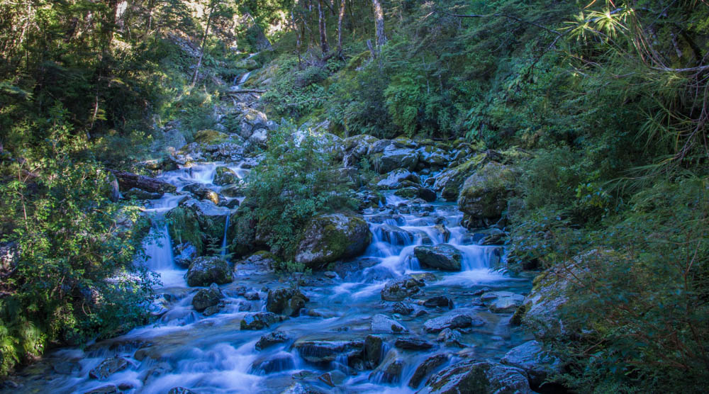
The trail follows the crystal-clear Route Burn River. This is a smaller stream feeding into the river.
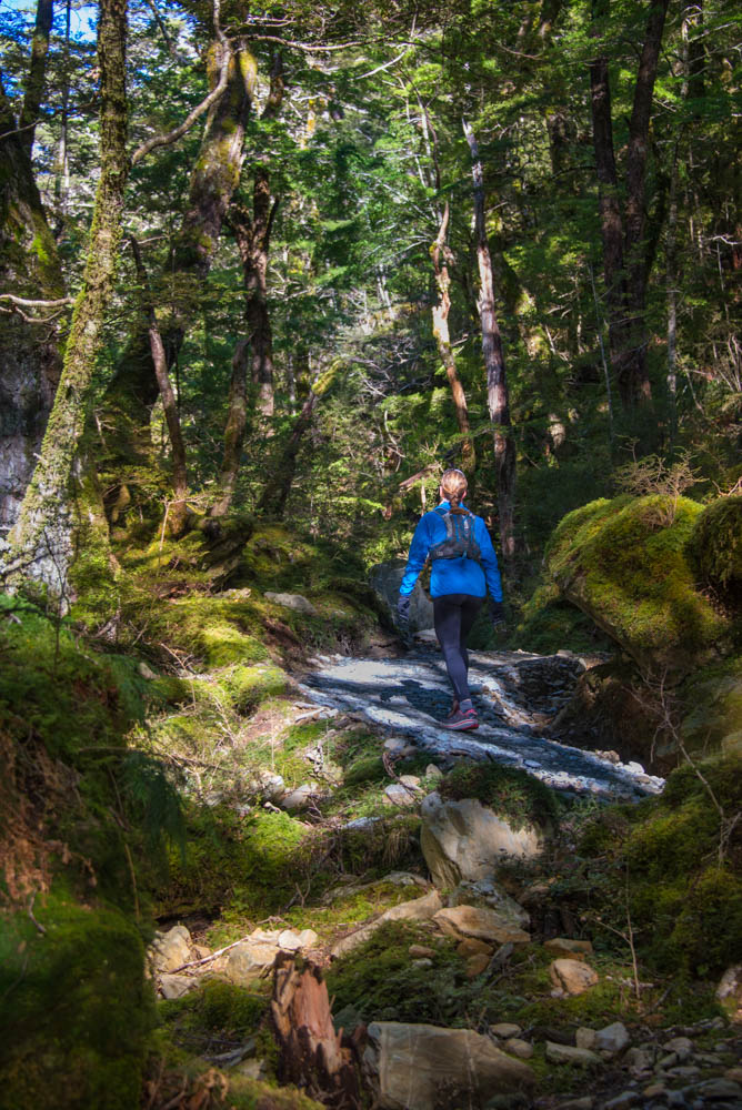
Smooth track through a lush beech tree forest on the way up to the first hut.
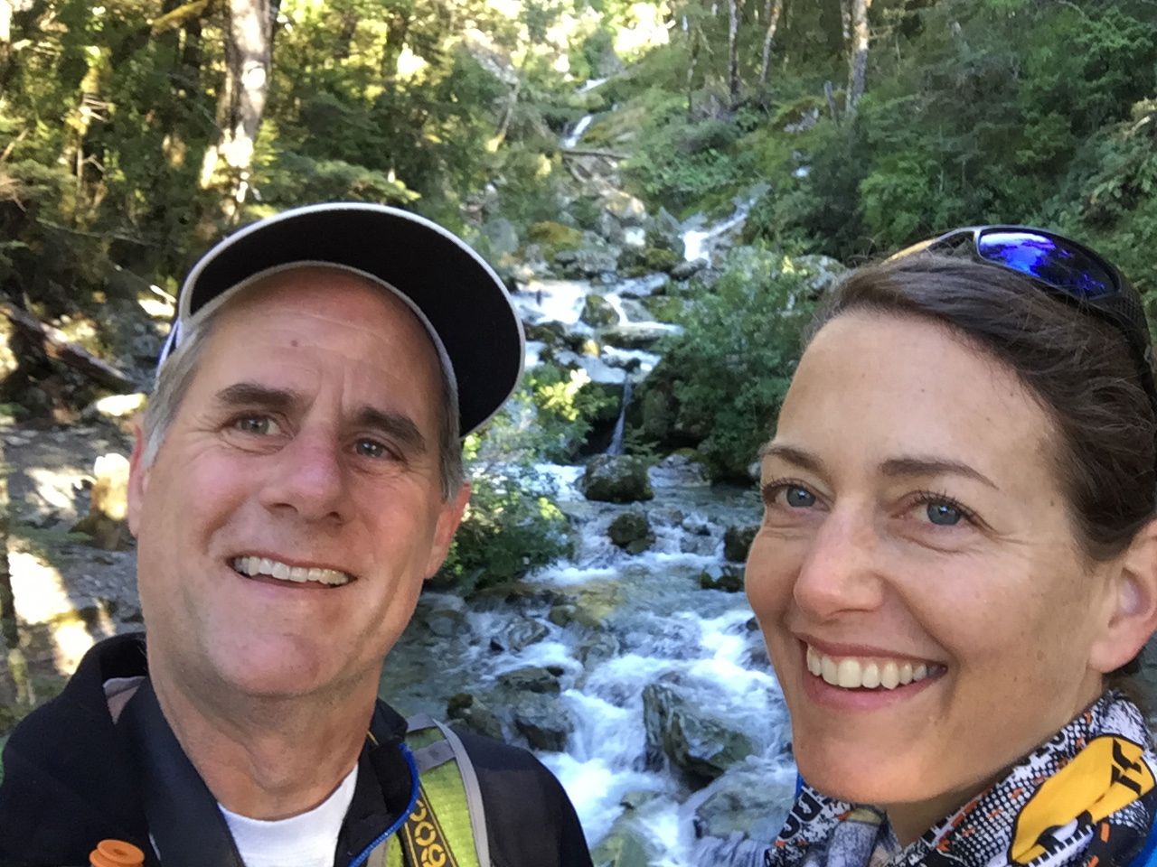
Obligatory selfie.
Moss and ferns carpet everything in the first part of the trail!
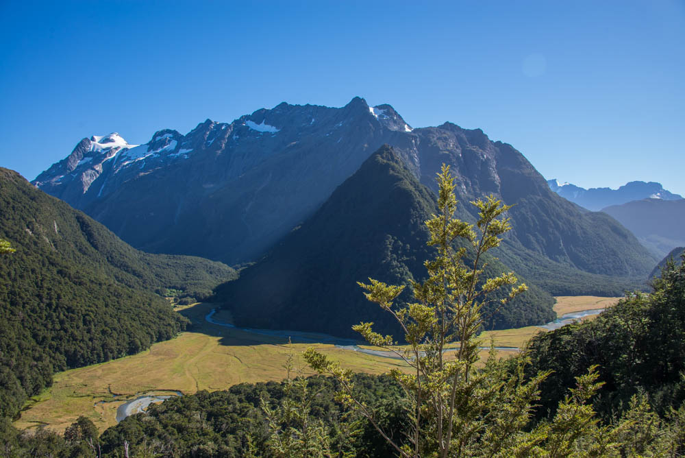
HIgher up, on the way to Routeburn Falls Hut, views open up to reveal the Humboldt Mountains.
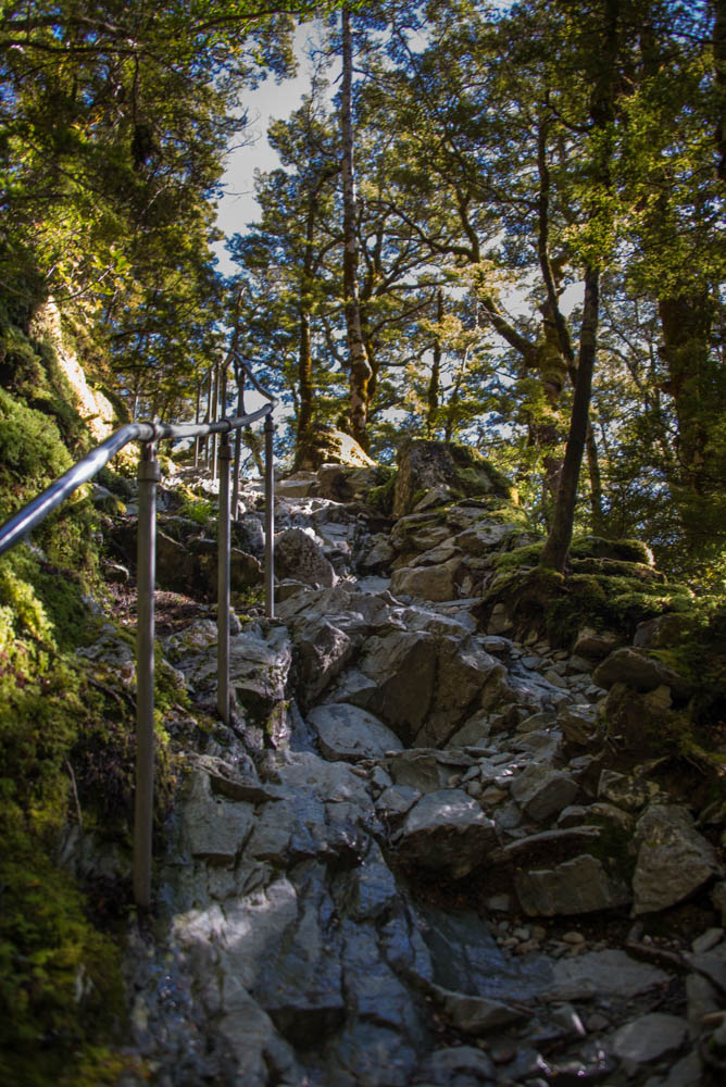
Approaching the Falls Hut, the trail turns rocky and a handrail is available in one stretch.
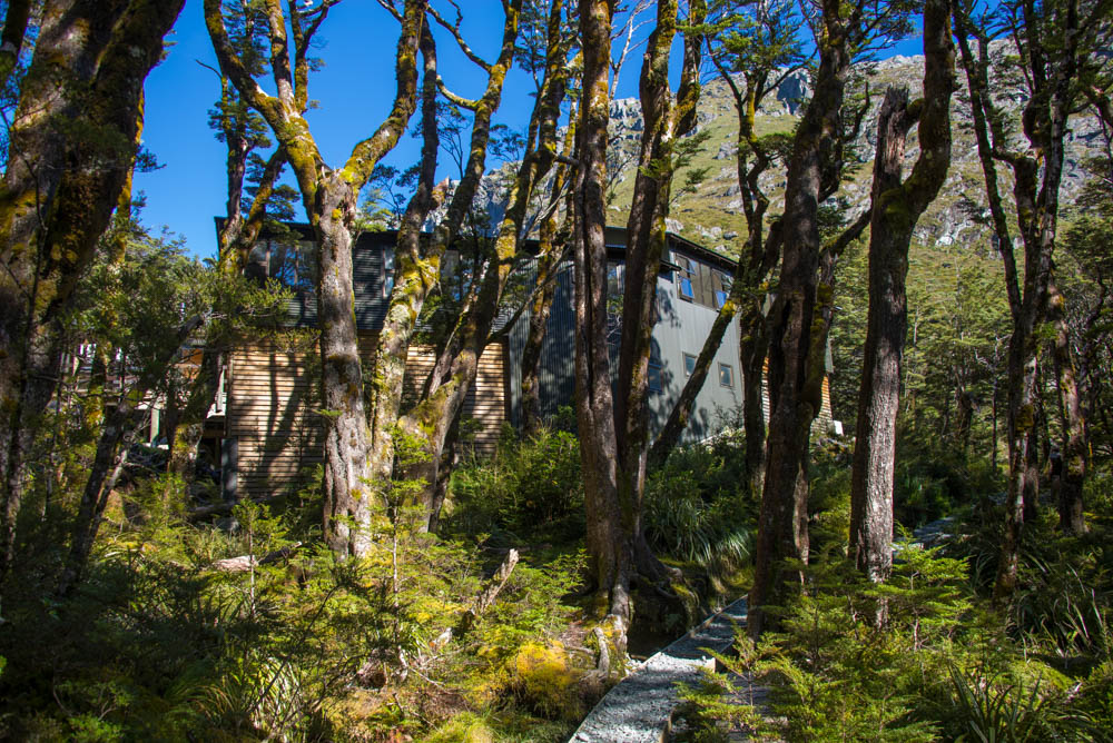
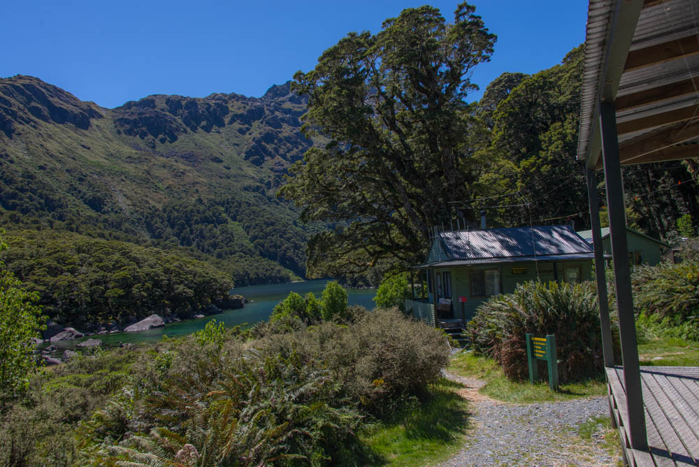
The Routeburn Falls Hut (8.8K/5.5 miles from the start at Routeburn Shelter) comes into view through the trees. It has 48 bunks, bathrooms and a communal kitchen, and in my view very well-done architecture. We stopped there for a break and snack.
Above Routeburn Falls Hut, the trail traverses larger boulders and leaves the forest for the “scrub zone” above tree line, on the way to Harris Saddle. I started getting hot and shedding layers.
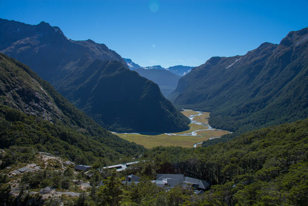
Looking at the rooftops of the Routeburn Falls Hut and the Humboldt Mountains. The first stretch of trail went along the river and through the forest on the right side of the photo.
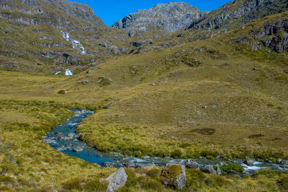
The trail meanders through this area above tree line covered with tussock (thick grass). Then it goes up the bluffs pictured here, toward the high point of Harris Saddle.
On the bluffs climbing to Harris Saddle, the trail passes under this cool A-frame of rocks.
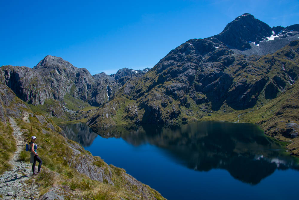
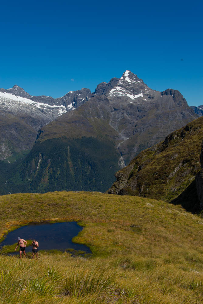
A “high point” of the hike: right before the summit, the trail passes by Lake Harris.
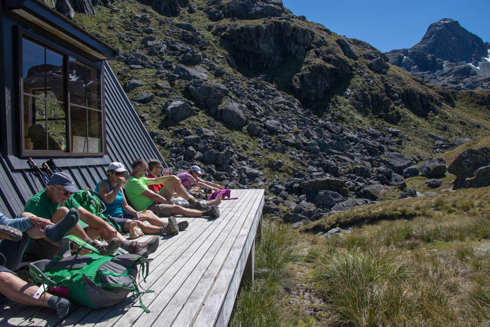
The hut at Harris Saddle (no beds, just shelter and toilet) where we and several hikers enjoyed a picnic. This summit point on the trail is at 1255 meters/4100 feet.
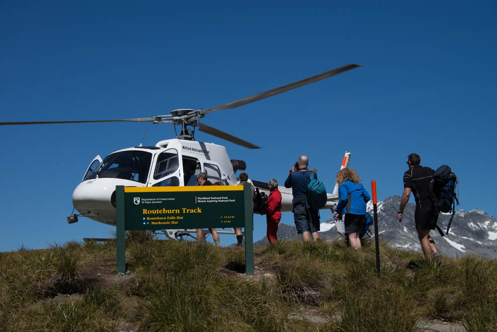
Some people took a helicopter instead of hiking. Wimps!
Several people went swimming in this pond next to the Harris Saddle Hut. Brrr!
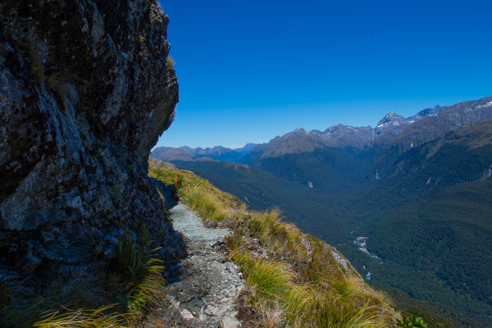
The trail leading down Harris Saddle traversing the Hollyford Face, toward Lake Mackenzie Hut. These views are of the Darran Mountains. We alternated hiking and slowly running these downhill stretches. You can see an orange-tipped stake; these are trail markers along the way.
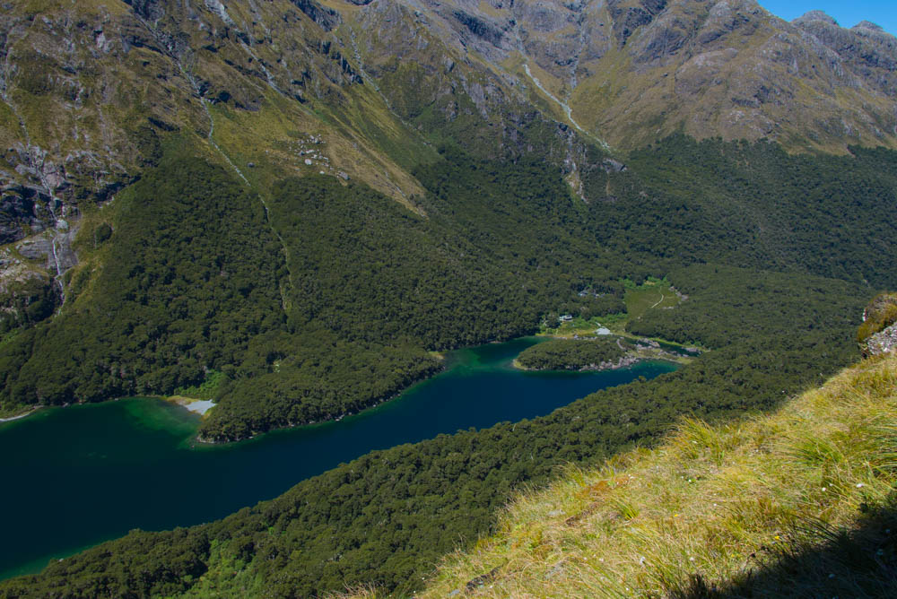
Coming down the mountain, Lake Mackenzie comes into view.
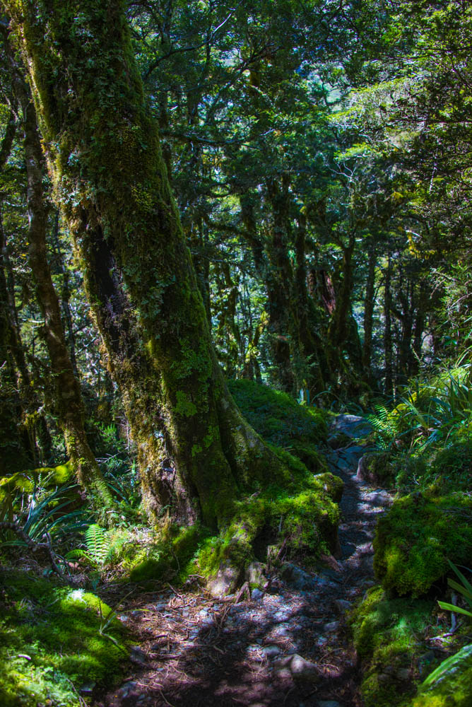
Once the trail re-entered the forest, it became very verdant again and somewhat rocky and technical.
Lake Mackenzie Hut (50 bunks), about 20K/12.5 miles from the start of the hike at Routeburn Shelter, with another approx. 12K/7.5 miles to the end at The Divide.
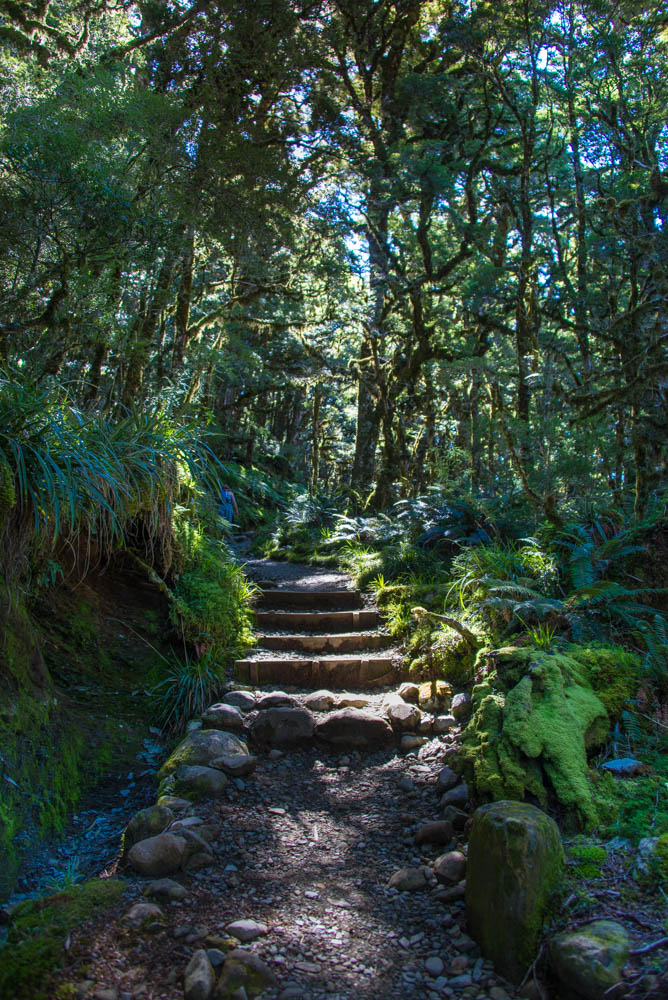
Pretty steps and single track somewhere in between Lake Mackenzie and Lake Howden huts.
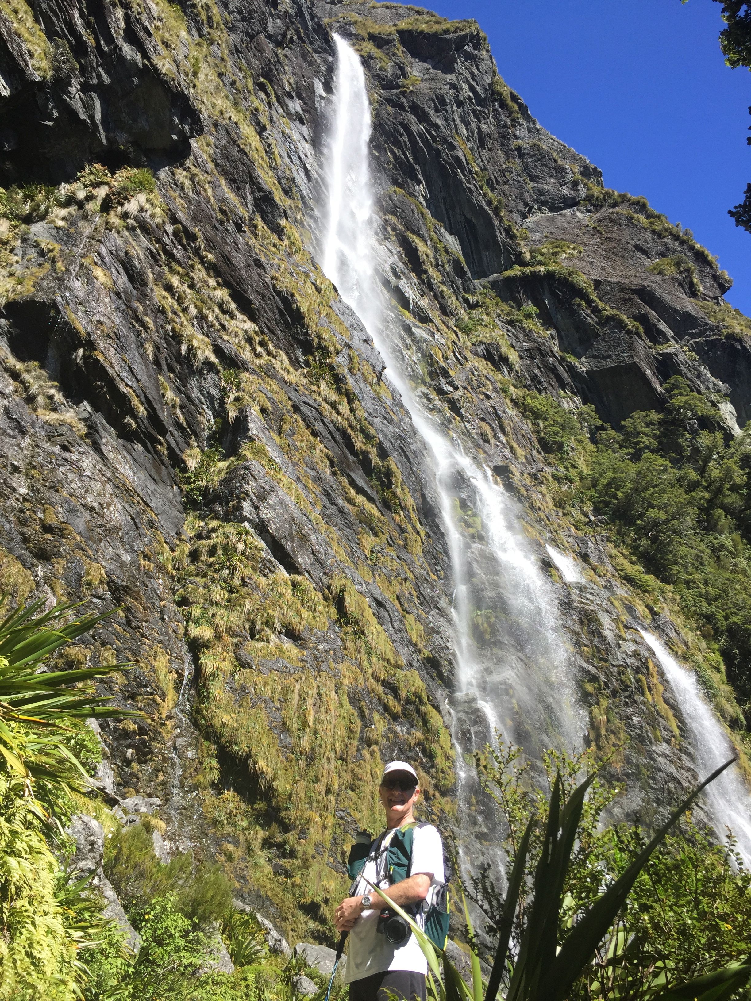
My crappy iPhone snapshot of Morgan in front of Earland Falls, which fails to capture the majesty of this 174 meter/570 foot cascade but at least gives a glimpse.
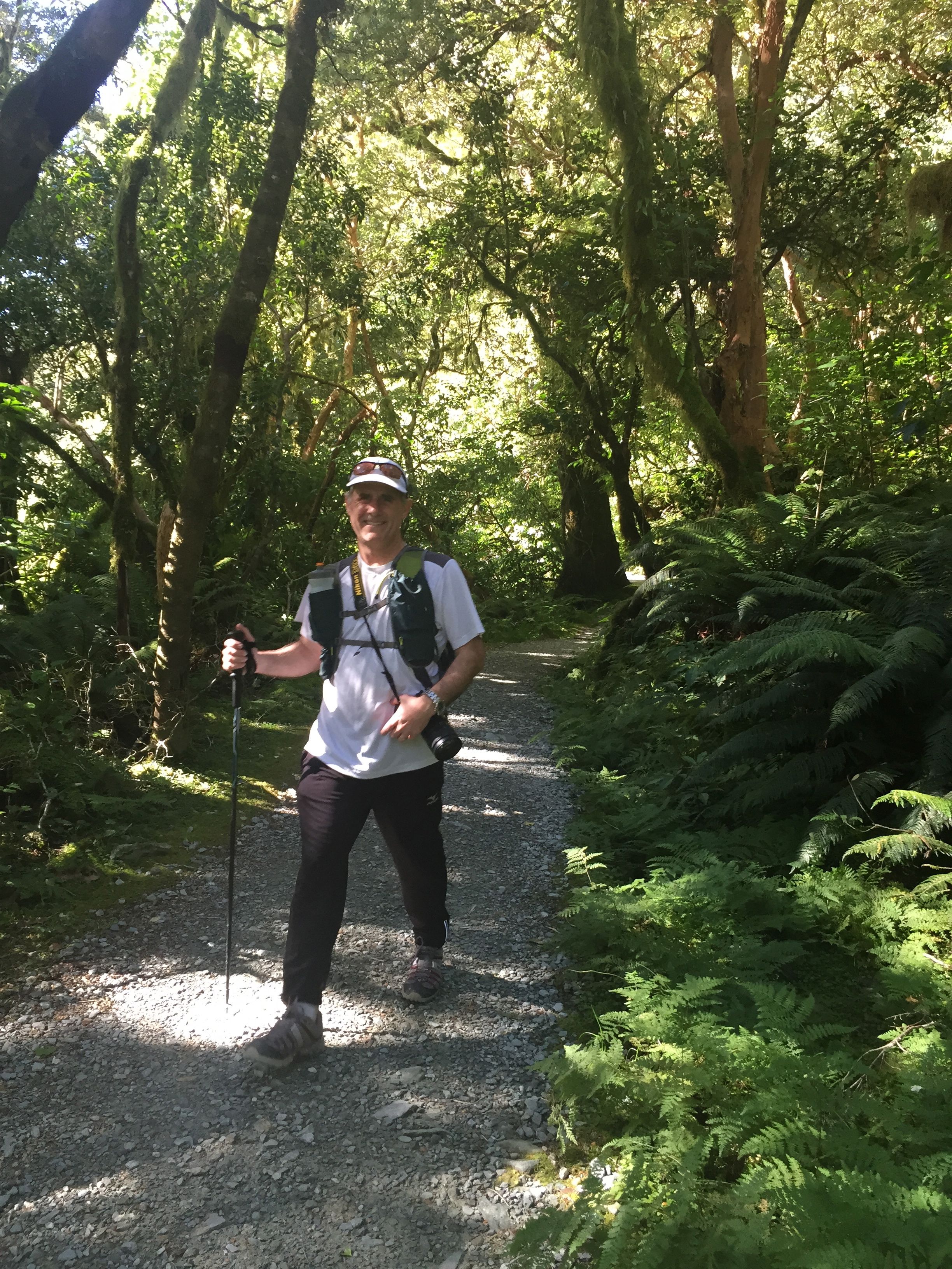
Morgan tramping along the final mile, on the descent to The Divide. It was approaching 5:00 in the afternoon, and we were starting to get just a little tired.
At the end of the hike, we got in our car, drove for about 40 minutes along the gorgeous Te Anau-Milford Highway, and checked into the Milford Sound Lodge. We had one night in an upscale, tastefully done modern-design chalet right at the river’s edge. (The room wasn’t available our second night there, so we transferred for that second night into a simple dorm room with a queen bed and shared bathroom, which was fine and more affordable.) If you can get this corner room—I think it was #14—book it! The floor-to-ceiling windows look out over the river that leads to the Sound. Pesky but pretty Kea birds hop around the deck outside and beg for food (which we did not give them; don’t feed the Keas!).
We got dinner at the cafe and brought it back to our room to eat—the perfect end to a perfect day.
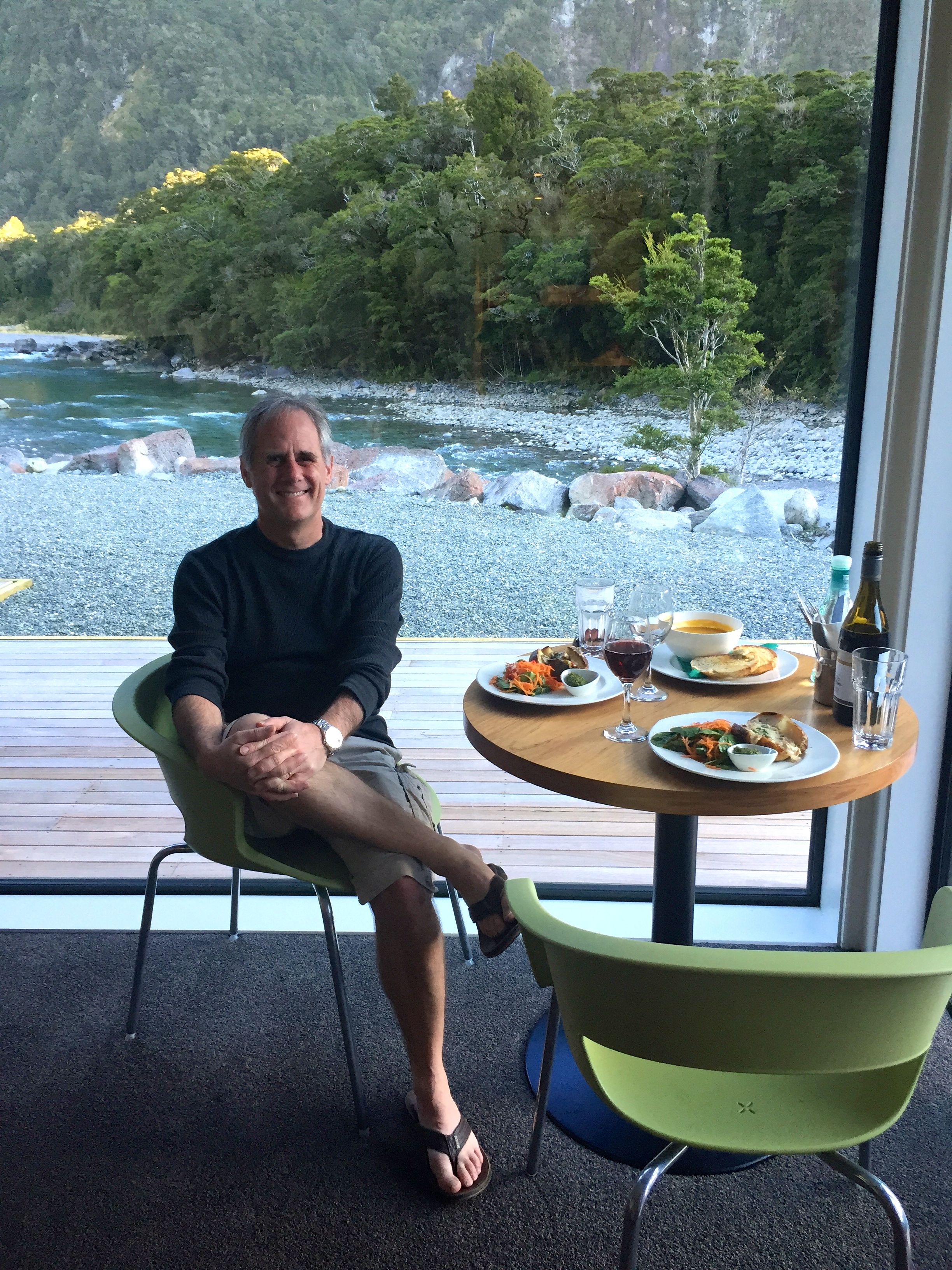
Post-hike dinner and wine in our lovely chalet room at Milford Sound Lodge. What a day!
The next day we hiked more and took an afternoon cruise on Milford Sound. Tip: take an afternoon cruise, not a midday one, because it’s much less crowded. Most of the day-tripping tourists arrive for a noon cruise and make it difficult to park by the harbor. The 3 p.m. cruise felt peaceful and less touristy. We did the “Encounter Nature Cruise” with Southern Discoveries and highly recommend it—the guide was great at explaining the geology and wildlife. The Milford Sound Lodge handled our booking the day before, so it didn’t seem like we needed to book it far in advance. To see a few of those photos from our boat ride, click here.
Please subscribe to this blog if you’d like regular updates on trail running and travel adventures.
Great post, and as a Kiwi who has been there before – you’ve just inspired me to head back!
2 things though: In winter (or after snow) – the Routeburn can be a totally different challenge, and 2+ days is justified. DOC don’t care about drumming up business for the locals, in fact – quite the opposite. Sadly NZ still has a large number of people die, and/or be rescued in our back country every year. (Taking 4 days however would involve a serious amount of detours and slow walking!)
Kia are the cars, “Kea” are cheeky little buggers that show no fear!
Glen, thank you so much (and I will fix the Kea spelling goof — I forgot that difference). You’re absolutely right with your note of caution about the snow. I should have made more clear I’m talking about summertime weather. We got very lucky with the blue-sky mild weather. You need to be in relatively good physical shape to do this in a day, AND have decent weather. But it seemed like a manageable day-long hike to us (I’m an ultrarunner but my husband is not; he hikes and runs a relatively short amount, and he had no problem with it). BTW Mike, the guy from Trackhopper, can run the whole thing in just over 3 hours! I think he said his best time was 3:11 — amazing.
Hi Sarah, my name is Andrew. I visited NZ from Ireland in 2004 and spent 3 months hiking in NZ. Including the Milford and Routeburn. Today I read that a lady stayed for 30 days by herself due to the fact that her partner fell and died along that track. They strayed off the track and became lost apparently. But I am surprised to hear it was the Routeburn as its not that big a place and also even in winter I would have expected other Mountain Runners and Hikers to use the Routeburn Track frequently? Anyway I was searching on Google for Mountain Running on the Routeburn Track to research this fact, when I came across this blog. Amazing pictures. I have relations living in NZ, e.g. Arrowtown so I just have to get back to NZ again for a hiking holiday. Perhaps during the Christmas period. Just to say great post and pictures. When the weather is nice and sunny and warm, NZ’s great tracks especially down the South Island are heaven.
Also I meant to say, that I read on one of the other comments about a run you did in Utah? I visited Capital Reef NP, Bryce and the Escalante National Mounament a couple of years ago. Amazing countryside. Wow what a coincidence reading about Utah and NZ in the one Blog. They are both two of my favorite places for the great outdoors.
Thank you Sarah for your mention of our business, Trackhopper.
It was great to talk to you and congratulations on your success in your run in Southern Utah.
If people are reasonably fit and well equipped, no problem to go across in 1 day.
They may not get very good views due to weather.
There is a very large range of fitness with the people who go across the track.
With doing the track over 3 days, you have a chance to avoid bad weather.
Most people don’t have time in their holiday plans to change dates to suit weather.
The west side of the track, Divide to Harris Saddle has 255 days of rain (5.5m of rain).
3 days is good as the worst of the rain normally lasts for about 3-6 hours.
This will give people time to avoid the worst of it.
Also, we give people a list of side tracks to fill their time on the track.
I haven’t heard from anyone who has done all of them 🙂
Last year, in the 3 months of summer, we had 15 days of snow on the track with 2 days leaving 10cm on the track 🙂 Lots of fun!
This year we had 5 snow falls with 1 leaving 10cm on the track.
I have been across in 1 meter of snow 3 times. 2 in spring and 1 in winter.
One year, the Kea descended on the Divide car park and started unscrewing the short aerials off the back of cars.
Kiyomi and I managed to find the home for 1 aerial but 1 became an orphan.
We put the aerial of our clients car in the glove box with a note 🙂
This only happened during one summer and hasn’t happened since.
They will be back 🙂
Best regards,
Mike
I came across your blog by googling “Routeburn 1-day hike” and you have truly inspired me! My fiance and I are honeymooning in New Zealand in late March/early May, and we want hiking/tramping to be the focus of our trip. Right now we are booked for two nights in Te Anau followed by two nights in Queenstown. We are talking about hiking Routeburn on the last day of our stay in Te Anau, with Trackhopper relocating our rental car to Queenstown. We are pretty fit, marathoners and avid hikers, but not ultrarunners. Do you think this is doable for us? Did you drink straight out of streams or did you bring a filter? Thanks again for the inspiration!
Good morning — yes — I think it’s totally do-able if you are marathoners and can average 2 – 3 miles per hour. You do not need to carry extra water as the water is safe to drink from the streams. One 20-oz bottle should be sufficient in between streams and huts where you can refill (unless it’s unusually hot, then you want to take two).
However, you are going during NZ’s autumn season, March – May. If it’s cold and potentially snowy, be sure to take extra layers and allow for more time. If the weather is bad with poor visibility, then one day may be pushing it. We got very lucky to have that blue-sky day! There is a comment at the end of my blog post about how much more challenging it is in bad weather. Good luck!
Thanks, Sarah! I think we’ll plan on doing the full 20 but give ourselves the option to do an out-and-back (or nothing) if the weather isn’t cooperating. Already really looking forward to our trip!
Super helpful article, thank you! I’ll have 3.5 weeks on the south island from mid-March to early April 2016 and I’m figuring out how to run the Milford, Abel Tasman, and Routeburn tracks, each in a day. Right now I’m thinking that, weather permitting, I could do the Milford, rest for a few days in Milford Sound Lodge, and then do the Routeburn! Only tough part might be hitching from the trailhead to Queenstown. I won’t have a car.
Thanks guys for the great article. It helped me prepare a lot and reconfirmed my beliefs that with good weather, this track could be done in a day (in summer). Worked perfectly today for me with all blue skies and even better views. I am not (yet) a marathoner, but a starting triathlete and am relatively fit. The conical hill sidetrack at ‘the saddle’ was pitch perfect. Also TrackHopper was a great help with relocating my car, thanks Mike!!
Great article, thanks Sarah, really helpful! I am visiting NZ from the UK in Jan 2017 and already researching adventures! Great to hear the Routeburn track is runnable in a day, we will probably start at The Divide and get our car relocated (will be in touch with Mike at Trackhopper nearer the time!).
I found your site while googling for running the Routeburn track – great to also see there is a new UD Vesta with bigger bottle pockets… And that you’re in Western States! Good luck with the training and run up to race day 🙂
Thanks for the brilliant article Sarah, that made me run the Routeburn track and the Tongariro Northern Circuit in February and March 2016 as daytrips.
I wanted to visit New Zealand after school and do some of the great walks, but never did it. Now, with a wife and two kids (4years/10months) I finally made it to New Zealand but was unable to do a hiking tour of several days.
Before I read your article, I just wanted to run the last part of the Routeburn (starting at the Routeburn Shelter) and the Tongariro Alpine Crossing. But after reading your text, I decided to do both the Routeburn and the Tongariro Northern Circuit (43km) as a trail run, which was awesome. It is definetely worth it! I had not run a marathon yet, just half-marathons but made it in less than 6 hours (10 hrs Tongariro), so it worked quite well.
But you have to be lucky with the weather. I waited two days full of rain in Te Anau before I started in sunshine. I took the first hiking bus from the campsite in Te Anau at 7.15 am, started at The Devide and ran to the Routeburn Shelter were I was lucky to hitchhike to Glenorchy were I was picked up by my family.
This information is ultra useful. My wife and I intend to follow your instruction for the 1 day hike plus the service from Trackhopper.
Thanks for the article, My wife and I were debating whether we could do the whole track in a day, and many, including the DOC advised against it. But after we read your article and a bit more planning, we did the track and a few side tracks in a day. We were lucky as it was sunny the whole day and it wasn’t too cold during late April. It was awesome and definitely doable!