I wrote this post four years ago, in the fall of 2013, and am updating it since I revisited this cool urban run last week. Now that the entrance to Yerba Buena Island is open and links to Treasure Island, you can loop around there for a longer run or bike ride!
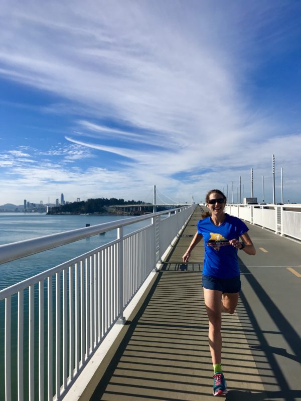
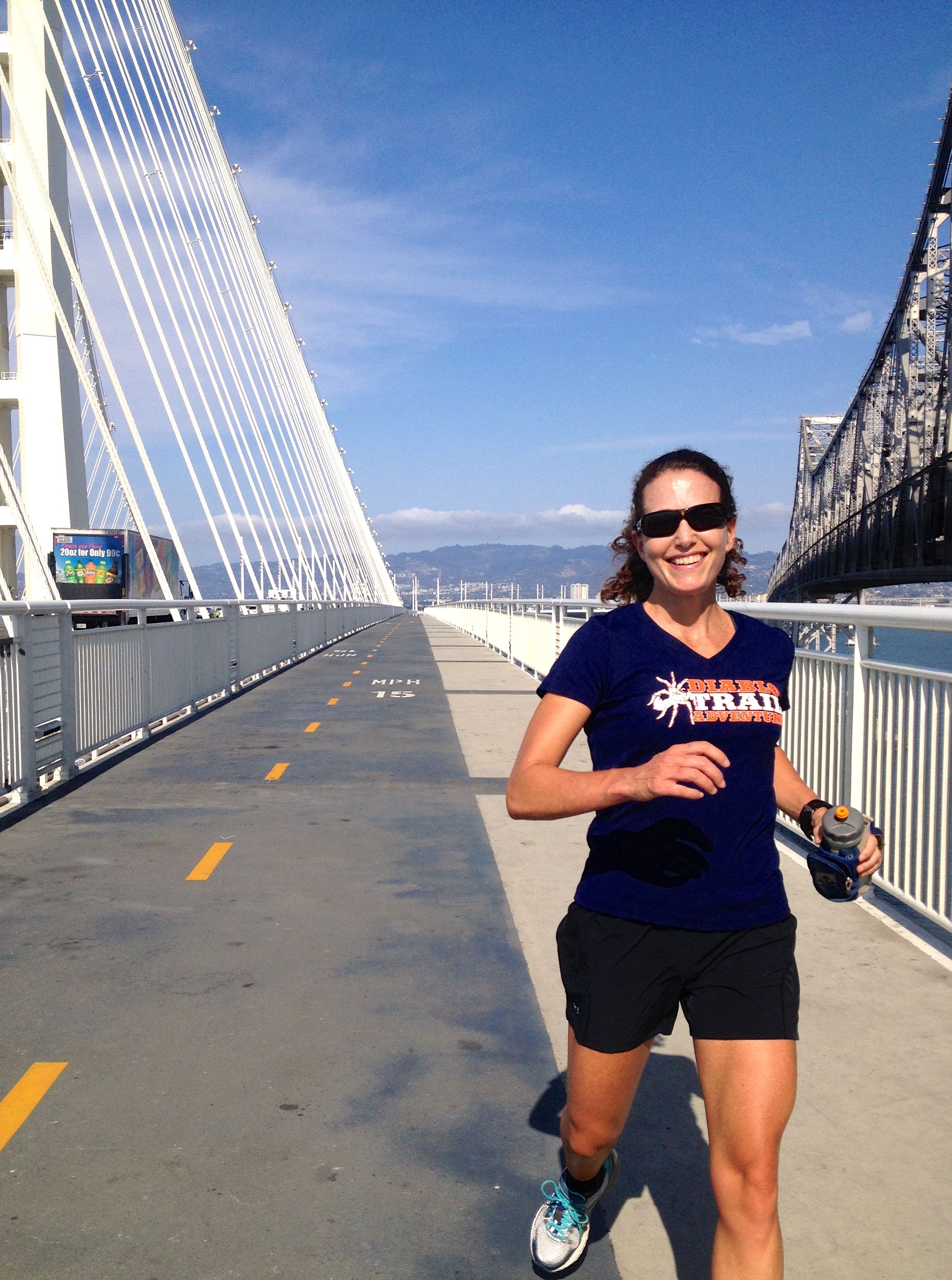
Striding out on the Bay Bridge Eastern Span a few days post-Thanksgiving 2017.
This afternoon, on a whim, I went for a run on the week-old bike and pedestrian path that runs along the new Eastern Span of the Bay Bridge. I glimpsed the path on our first drive over the new bridge last weekend (the $6.4 billion span opened to traffic in September of 2013) and thought, “That looks so cool!”
So, does the hard-fought, years-in-the-making bike path live up to the hype and meet expectations?
For anyone living in or visiting the East Bay, here’s my review of the path. I definitely think it’s worth running or cycling, at least once to check it out.
First, it’s obvious it’s not done—it’s a work in progress. It stops 1000 feet short of its destination (Yerba Buena Island) and won’t access the island until the old bridge is torn down, about two years from now. Eventually, one can only hope, a lane will be built to ride or run all the way into San Francisco.
UPDATE: The pedestrian path now connects to Yerba Buena Island and links to Treasure Island—see below for details.
Since it’s an out-and-back, you don’t run over the bridge the way you do on the Golden Gate. Instead, you unceremoniously encounter a metal barrier and have to turn around. For this reason, I like what this article called it: “the world’s longest bike pier.”
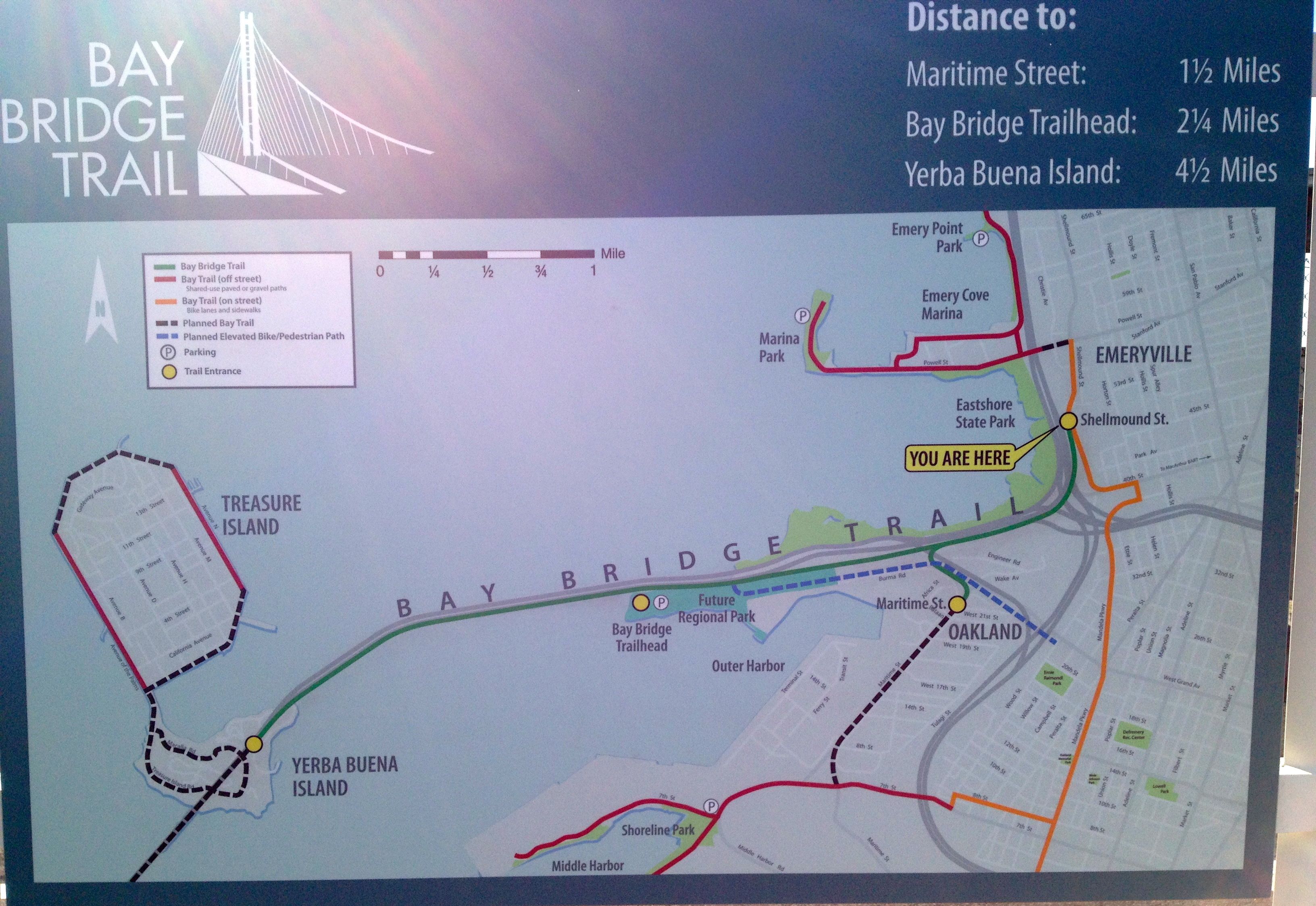
The Bay Bridge Trail map at the start across from Ikea in Emeryville.
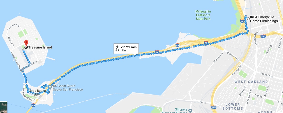
I parked at Ikea in Emeryville and picked up the path across the street. (Check out this website for the latest news on this path and for directions to a dedicated parking lot at 210 Burma Road in Oakland.) Technically, you’re not supposed to park at Ikea unless you are shopping there. You can pay for parking at the Bay Street mall a block away, or take a ride service there, or use the parking lot at another trailhead, the Caltrans Bridge Yard Building at 210 Burma Road.
The first mile is a real treat—it’s fascinating to run under The Maze, to see up close the underbelly of what we mindlessly drive over. For parents with young kids, just doing this mile would be a fun little bike ride or walk.
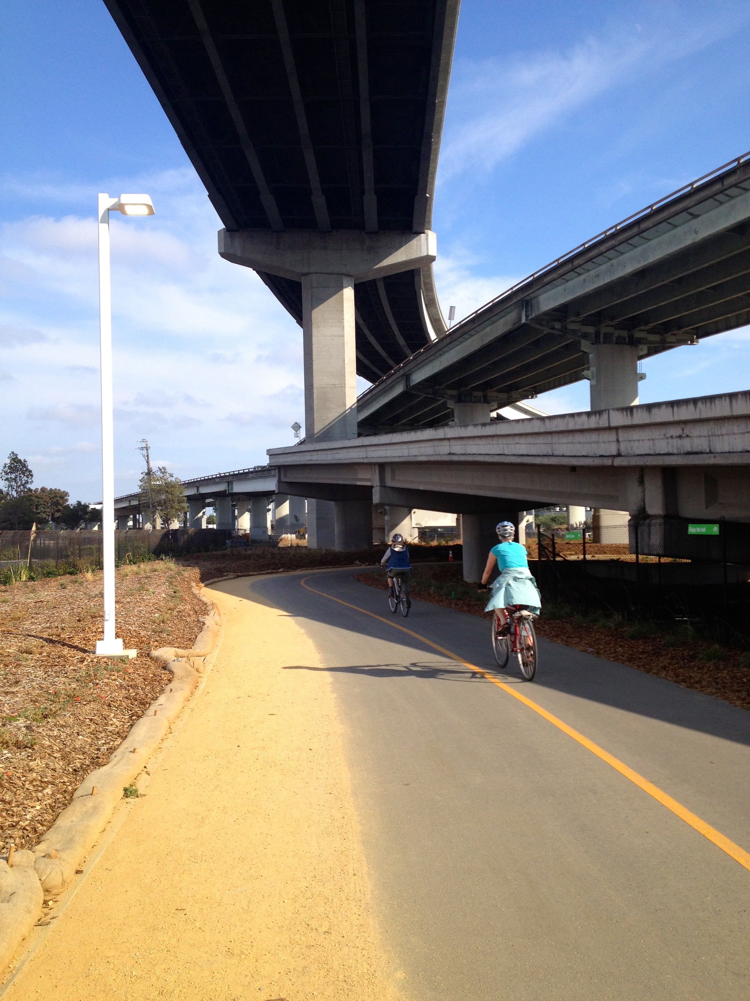
The start of the path, under the maze. A nice dirt strip for pedestrians borders the paved bike path for the first mile.
This first mile or so also features good signage. Sometimes the signage can create a funny juxtaposition, as in this photo below, where the pretty “save the bay” environmental message contrasts with the ugly industrial scene directly in view:
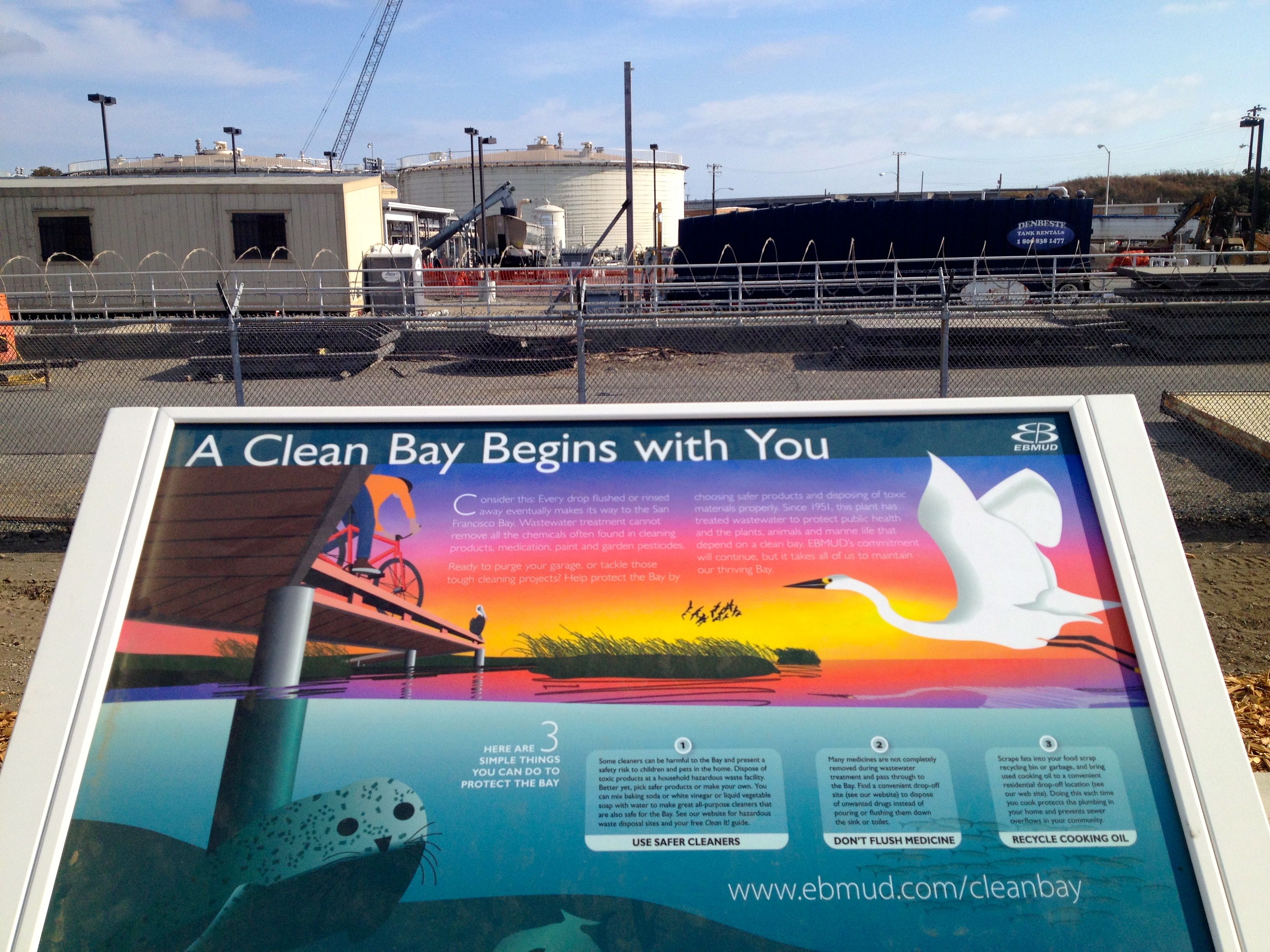
A sign and “scenery.”
By 1.5 miles, you reach the toll plaza, which is interesting to see from this angle. Here you’ll find a row of well-maintained toilets. Take a break to use one because there are none the rest of the way. You’ll also notice there are no drinking fountains.
But, I carried water, so I was fine. Better than fine—I really enjoyed striding out and taking in the sights. It’s not exactly pretty, but it’s quite interesting to see the construction debris and the old bridge stopping abruptly.
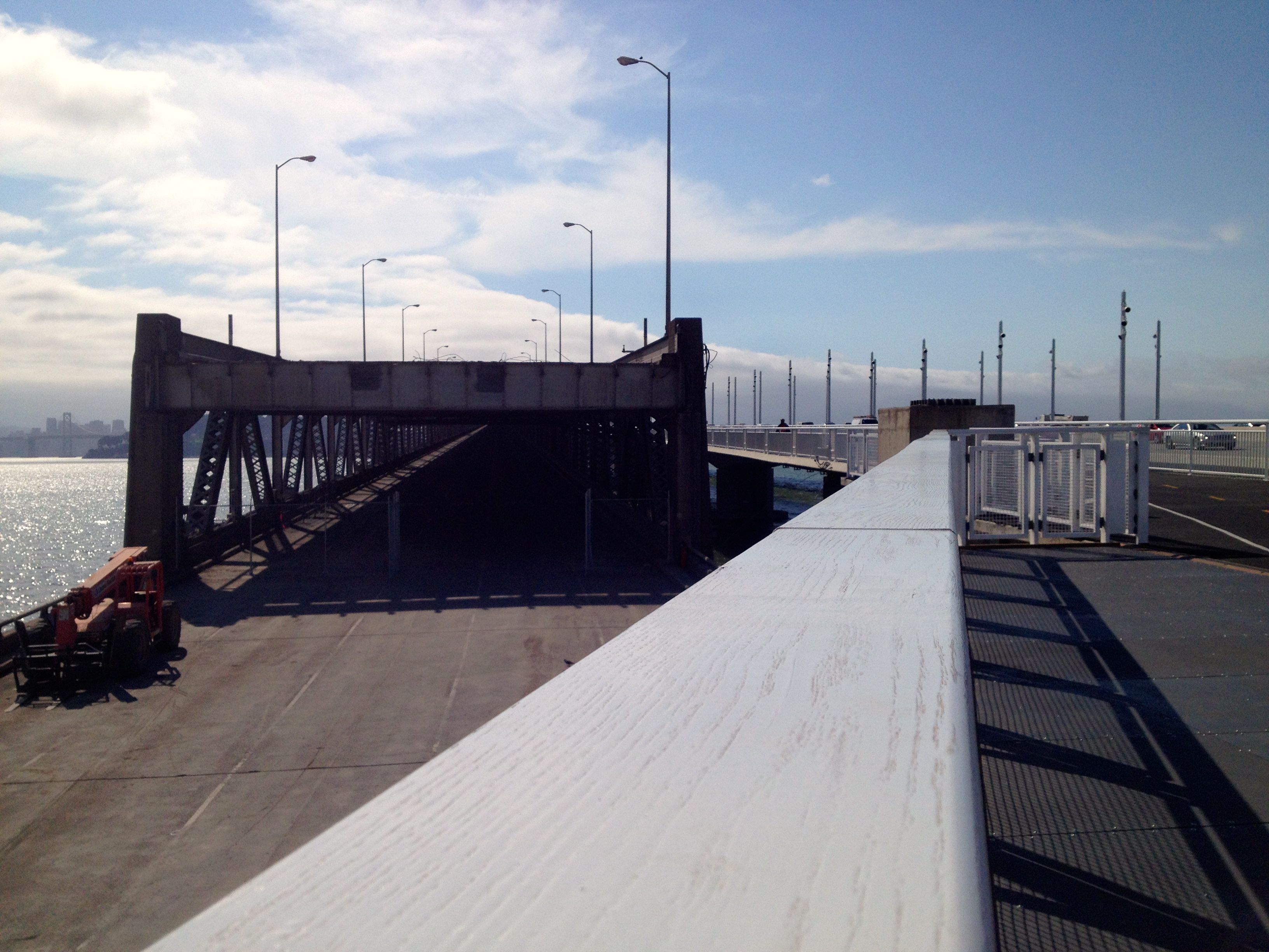
At Mile 2, the old bridge on the left stops abruptly in front of the new ramp to the new bridge on the right.
Update: The old Bay Bridge is long gone now!
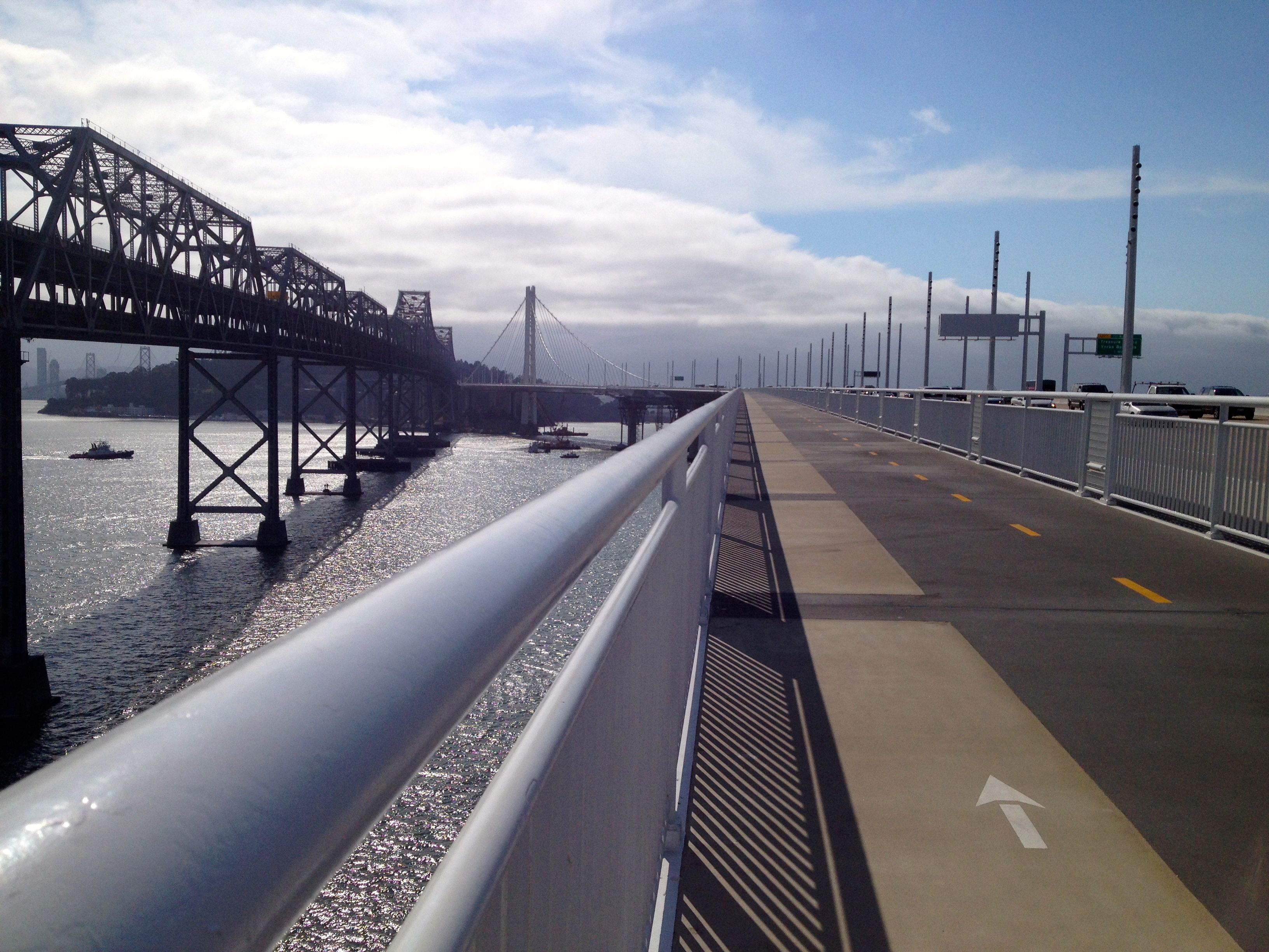
The two miles to the turnaround on the bridge are perfectly smooth and might lull you into a trance due to the white noise of the traffic and the repeating lines of the bridge structure. But I’d rather zone out and run steadily here than on a treadmill.
Given that we have few paved, flat paths to run here in Berkeley and Oakland, this is a great place to go if you want to train on a fast and relatively flat surface with a gentle incline, or if you have a baby in a stroller and want a smooth traffic-free path on which to push it. I like to run the Eastshore Path along Highway 80 occasionally, between Emeryville and Richmond, and this is a welcome add-on to that path for training.
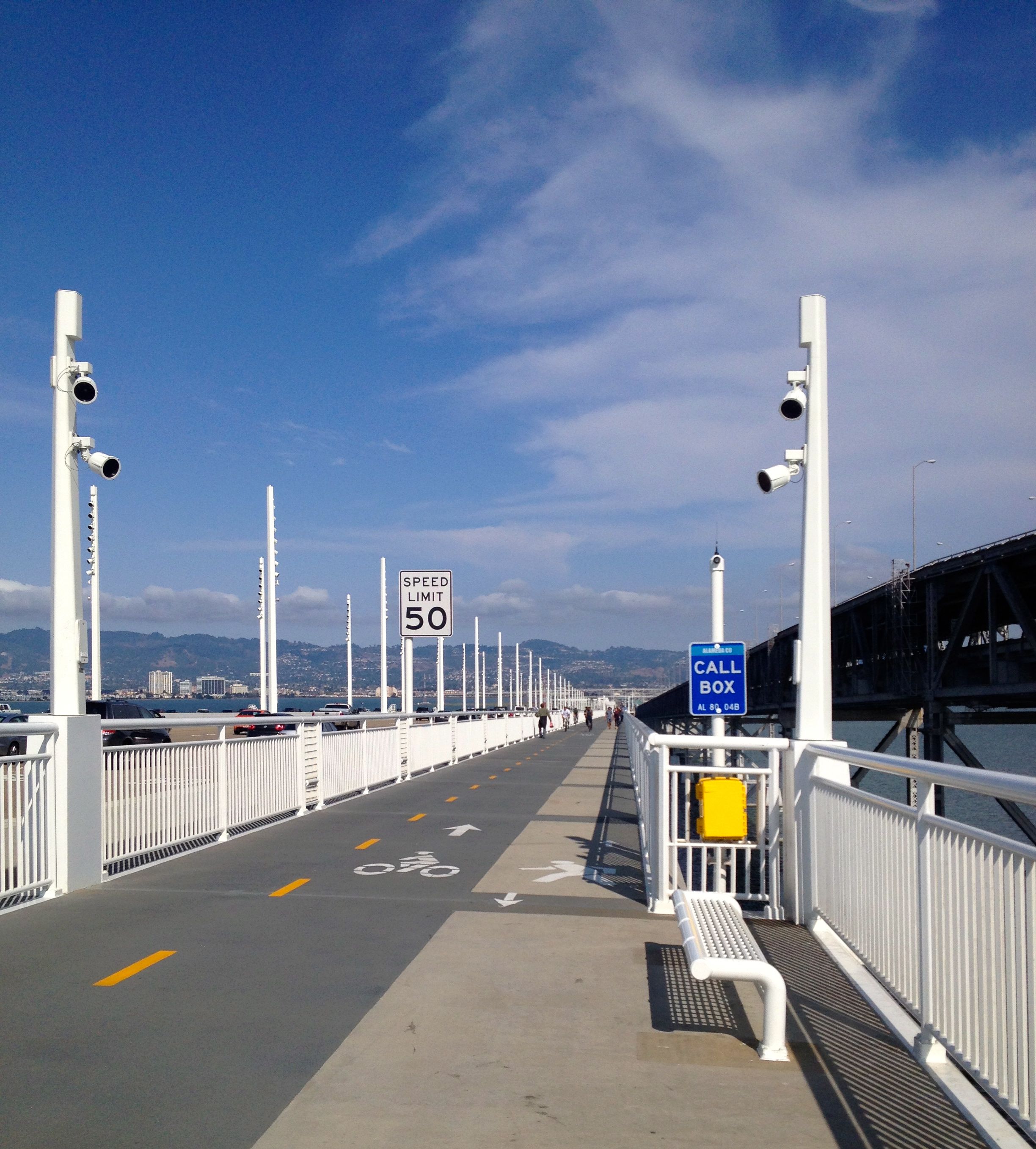
The path approaching the curve to the island.
At around the 3-mile mark, looking back toward Oakland. Nice benches, but they could use a trashcan nearby.
I reached the turnaround and chatted with a bike cop who took this next photo of me. Now that’s a beat I’d like to work if I were a cop!
Reaching Mile 4 and the turnaround.
UPDATE: When you reach the island, 4.4 miles from the trailhead across from Ikea, you’ll see the lovely Yerba Buena Island Vista Point on your left. A good, new drinking fountain stands next to it, and a bathroom.
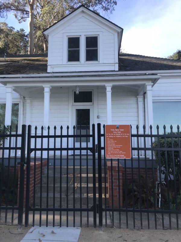
The historic house at the Yerba Buena Vista Point, right next to the end of the pedestrian/bike path, where you can find a drinking fountain.
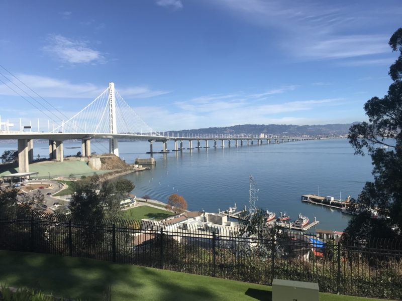
A view of the eastern span from Yerba Buena Vista Point.
From the vista point, take a left up Hillcrest Road, which becomes Treasure Island Road, to run clockwise to the west side of Yerba Buena. You have to run on the shoulder of the road in a bike lane here, but it’s wide enough that I felt safe in spite of some zooming cars. And the city views on the other side are worth it. Looking at a map now, however, I see there are roads cutting across the top part of the island that look more pedestrian-friendly, which I have yet to explore.
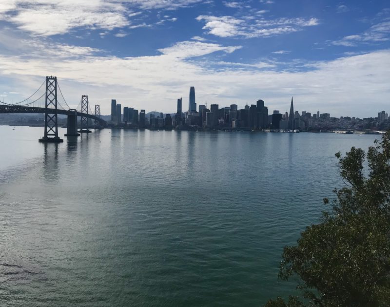
San Francisco’s skyline seen from Yerba Buena Island.
I loved running this hill down toward Treasure Island because it’s where I ran my very first 10K and second race ever (the first being the Bay to Breakers) as a rookie runner in 1994.
I ran a short out-and-back on the strip of land that connects the two islands and reluctantly turned around to head home, tight on time. I’ll have to go back to run around the whole perimeter of Treasure Island next time. My out-and-back run totaled about 11 miles.
If you’re looking for a cityscape run, I recommend this route!
First thing I noticed – it looks like you almost had the bridge to yourself! It’s probably not like that on weekends, but still, most of those pictures show an empty trail. And good call about the trash cans – they really need several or else people will just toss their stuff in the water. Thanks for being brave and trying this out for us. (Oh, and nice shirt!)
I just biked the Golden Gate Bridge with a cousin once removed (from Japan) yesterday. It SUCKED! Too many people, too much smog. Looks like the Bay Brige has fewer people and more space separating the path from the traffic.
Though I think she had fun…
Thanks for the helpful info! I came across your post as I was planning on running the Bay Bridge, which I did yesterday. Would’ve been completely lost without your post and the KQED article.